Santorini volcano,satellite image
Bildnummer 11740785
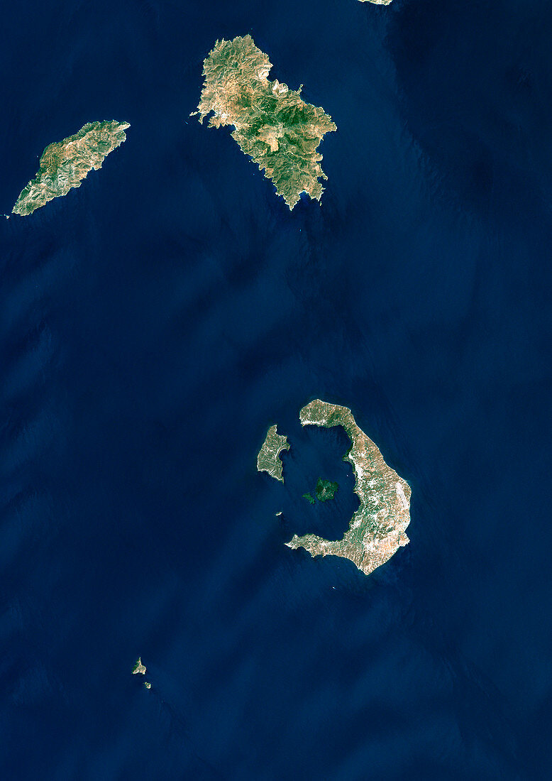
| Santorini volcano,Greece,satellite image. North is at top. The sea-filled caldera (lower right) shows where a massive volcanic eruption some 3500 years ago destroyed most of the island of Santorini (also called Thera). The island is part of the Cyclades archipelago,south-east of the Greek mainland. The caldera is about 12 kilometres long. Image data obtained on 8 August 1999 | |
| Lizenzart: | Lizenzpflichtig |
| Credit: | Science Photo Library / Planetobserver |
| Bildgröße: | 3508 px × 4962 px |
| Modell-Rechte: | nicht erforderlich |
| Eigentums-Rechte: | nicht erforderlich |
| Restrictions: | - |
Preise für dieses Bild ab 15 €
Universitäten & Organisationen
(Informationsmaterial Digital, Informationsmaterial Print, Lehrmaterial Digital etc.)
ab 15 €
Redaktionell
(Bücher, Bücher: Sach- und Fachliteratur, Digitale Medien (redaktionell) etc.)
ab 30 €
Werbung
(Anzeigen, Aussenwerbung, Digitale Medien, Fernsehwerbung, Karten, Werbemittel, Zeitschriften etc.)
ab 55 €
Handelsprodukte
(bedruckte Textilie, Kalender, Postkarte, Grußkarte, Verpackung etc.)
ab 75 €
Pauschalpreise
Rechtepakete für die unbeschränkte Bildnutzung in Print oder Online
ab 495 €
Keywords
- 1900er Jahre,
- 1990er Jahre,
- 20. Jahrhundert,
- August,
- Caldera,
- Erdbeobachtung,
- Erdkunde,
- Europa,
- europäisch,
- geografisch,
- Geographie,
- Geologie,
- geologisch,
- Griechenland,
- Griechisch,
- Insel,
- Natur,
- Satellit,
- Satellitenbild,
- Sommer,
- Supervulkan,
- thera,
- überflutet,
- Umwelt,
- Vulkan,
- vulkanisch,
- Vulkanologie,
- Weltall