Mount Ararat
Bildnummer 11740738
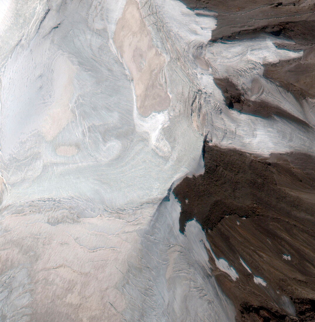
| Mount Ararat. Satellite image of a plateau at an altitude of 4720 metres on Mount Ararat,Turkey. The summit (not seen) is at an elevation of 5165 metres. This area,only a few kilometres across,consists of snow and ice (white) and bare ground (brown). This area is the north-western part of the mountain's Western Plateau. Mount Ararat is a snow-capped dormant volcano. It is said to be where Noah's Ark came to rest after the enormous flood that is described in the Judeo-Christian bible. Image taken by the Ikonos satellite on 13 September 2000 | |
| Lizenzart: | Lizenzpflichtig |
| Credit: | Science Photo Library / Geoeye |
| Bildgröße: | 3032 px × 3102 px |
| Modell-Rechte: | nicht erforderlich |
| Eigentums-Rechte: | nicht erforderlich |
| Restrictions: | - |
Preise für dieses Bild ab 15 €
Universitäten & Organisationen
(Informationsmaterial Digital, Informationsmaterial Print, Lehrmaterial Digital etc.)
ab 15 €
Redaktionell
(Bücher, Bücher: Sach- und Fachliteratur, Digitale Medien (redaktionell) etc.)
ab 30 €
Werbung
(Anzeigen, Aussenwerbung, Digitale Medien, Fernsehwerbung, Karten, Werbemittel, Zeitschriften etc.)
ab 55 €
Handelsprodukte
(bedruckte Textilie, Kalender, Postkarte, Grußkarte, Verpackung etc.)
ab 75 €
Pauschalpreise
Rechtepakete für die unbeschränkte Bildnutzung in Print oder Online
ab 495 €