Mount St Helens volcano
Bildnummer 11740654
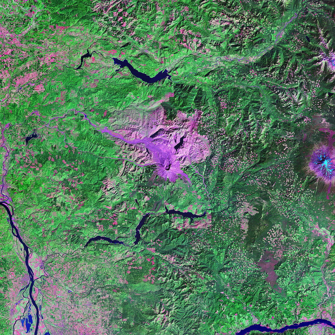
| Mount St Helens volcano. Coloured optical and infrared,Landsat satellite image of the volcano Mount St Helens (pink),Washington State,USA. North is at top. Forested areas are green,bare land is pink,water is black,and snow and ice are pale blue. Mount St Helens erupted in 1980 with a titanic blast that ripped out the north and north- eastern sides of the volcano. The blast flattened trees over a 600-square-kilometre area (pink). Snow lies atop Mount Adams at far right. Red areas seen in the forests that lie between are clear-cut areas where trees have been removed for timber | |
| Lizenzart: | Lizenzpflichtig |
| Credit: | Science Photo Library / MDA Information Systems |
| Bildgröße: | 4000 px × 4000 px |
| Modell-Rechte: | nicht erforderlich |
| Eigentums-Rechte: | nicht erforderlich |
| Restrictions: | - |
Preise für dieses Bild ab 15 €
Universitäten & Organisationen
(Informationsmaterial Digital, Informationsmaterial Print, Lehrmaterial Digital etc.)
ab 15 €
Redaktionell
(Bücher, Bücher: Sach- und Fachliteratur, Digitale Medien (redaktionell) etc.)
ab 30 €
Werbung
(Anzeigen, Aussenwerbung, Digitale Medien, Fernsehwerbung, Karten, Werbemittel, Zeitschriften etc.)
ab 55 €
Handelsprodukte
(bedruckte Textilie, Kalender, Postkarte, Grußkarte, Verpackung etc.)
ab 75 €
Pauschalpreise
Rechtepakete für die unbeschränkte Bildnutzung in Print oder Online
ab 495 €
Keywords
- Abholzung,
- Amerika,
- Amerikanisch,
- Berg,
- Berge,
- Bodennutzung,
- Erdkunde,
- farbig,
- geografisch,
- Geographie,
- Geologie,
- infrarot,
- ir,
- Mt.,
- optisch,
- Satellitenbild,
- trocken,
- uns,
- USA,
- Vegetation,
- Vereinigte Staaten,
- Vulkan,
- vulkanisch,
- Wald,
- Wasser,
- Weltall