Santorini before and after explosion of 1470 BC
Bildnummer 11740559
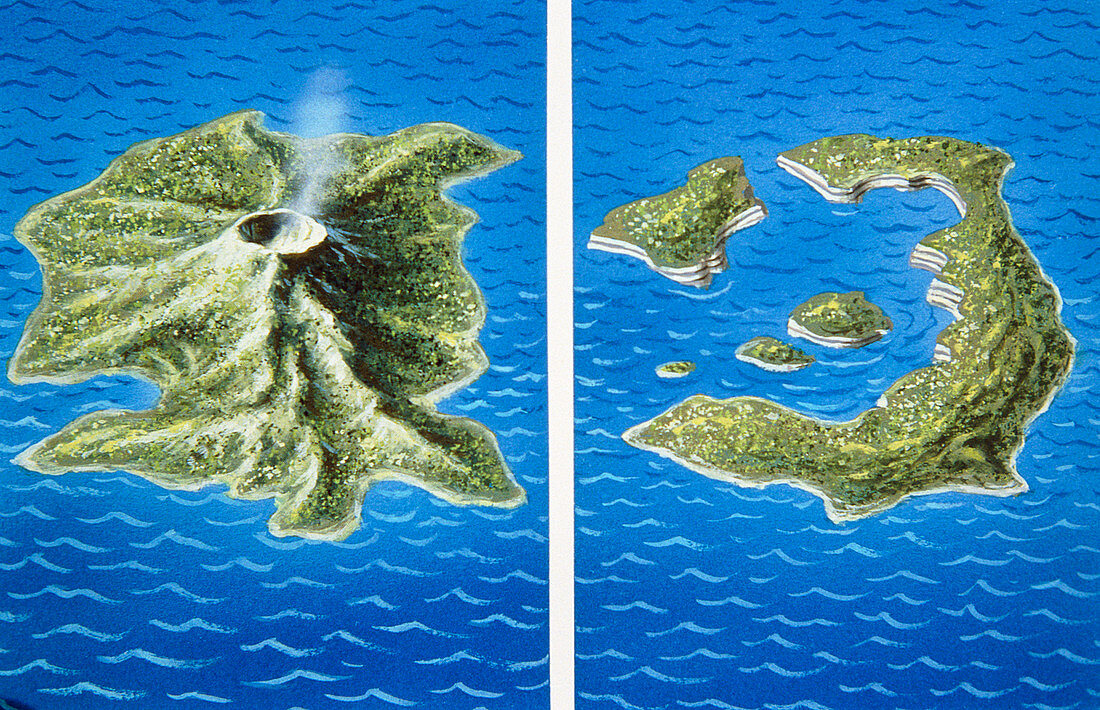
| Illustration showing the possible shape of Santorini before and after the eruption of 1470BC. Santorini is an island in the Aegean Sea,about 100 km north of Crete. Positioned near a destructive plate margin,the island probably looked like the frame at left,with a central large volcano. This volcano suffered a catastrophic caldera collapse in 1470 BC,similar to but much larger than the explosion of Krakatau in Indonesia in 1883. All that is left today is a small ring of islands. It is possible that a Minoan city state on the island,destroyed in the eruption,was the basis for the legend of Atlantis | |
| Lizenzart: | Lizenzpflichtig |
| Credit: | Science Photo Library / Hardy, David |
| Bildgröße: | 5116 px × 3300 px |
| Modell-Rechte: | nicht erforderlich |
| Eigentums-Rechte: | nicht erforderlich |
| Restrictions: | - |
Preise für dieses Bild ab 15 €
Universitäten & Organisationen
(Informationsmaterial Digital, Informationsmaterial Print, Lehrmaterial Digital etc.)
ab 15 €
Redaktionell
(Bücher, Bücher: Sach- und Fachliteratur, Digitale Medien (redaktionell) etc.)
ab 30 €
Werbung
(Anzeigen, Aussenwerbung, Digitale Medien, Fernsehwerbung, Karten, Werbemittel, Zeitschriften etc.)
ab 55 €
Handelsprodukte
(bedruckte Textilie, Kalender, Postkarte, Grußkarte, Verpackung etc.)
ab 75 €
Pauschalpreise
Rechtepakete für die unbeschränkte Bildnutzung in Print oder Online
ab 495 €