Vesuvius & Naples seen from space,Landsat 4 TM
Bildnummer 11740539
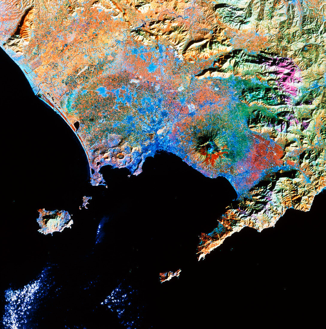
| False-colour satellite image of the area around Naples,Italy. The dominant feature in the centre of the image is the cone of Mount Vesuvius,a 1277 metre high active volcano. The pale blue colour around the crater represents volcanic ash,the red patch just below the crater is lava from the 1944 eruption. The city of Naples is on the coast left of the volcano (dark blue). Naples occupies part of a largely agricultural plain bounded by the Picentini Mountains (top right) and the Mediterranean Sea. The islands off the coast are Ischia (left),its smaller neighbour Procida,and Capri (below centre). This image was made by the Landsat 4 satellite in 1983 | |
| Lizenzart: | Lizenzpflichtig |
| Credit: | Science Photo Library / NRSC LTD |
| Bildgröße: | 3544 px × 3580 px |
| Modell-Rechte: | nicht erforderlich |
| Eigentums-Rechte: | nicht erforderlich |
| Restrictions: | - |
Preise für dieses Bild ab 15 €
Universitäten & Organisationen
(Informationsmaterial Digital, Informationsmaterial Print, Lehrmaterial Digital etc.)
ab 15 €
Redaktionell
(Bücher, Bücher: Sach- und Fachliteratur, Digitale Medien (redaktionell) etc.)
ab 30 €
Werbung
(Anzeigen, Aussenwerbung, Digitale Medien, Fernsehwerbung, Karten, Werbemittel, Zeitschriften etc.)
ab 55 €
Handelsprodukte
(bedruckte Textilie, Kalender, Postkarte, Grußkarte, Verpackung etc.)
ab 75 €
Pauschalpreise
Rechtepakete für die unbeschränkte Bildnutzung in Print oder Online
ab 495 €