Nimbus-7 TOMS SO2 post El Chichon eruption 5/4/82
Bildnummer 11740528
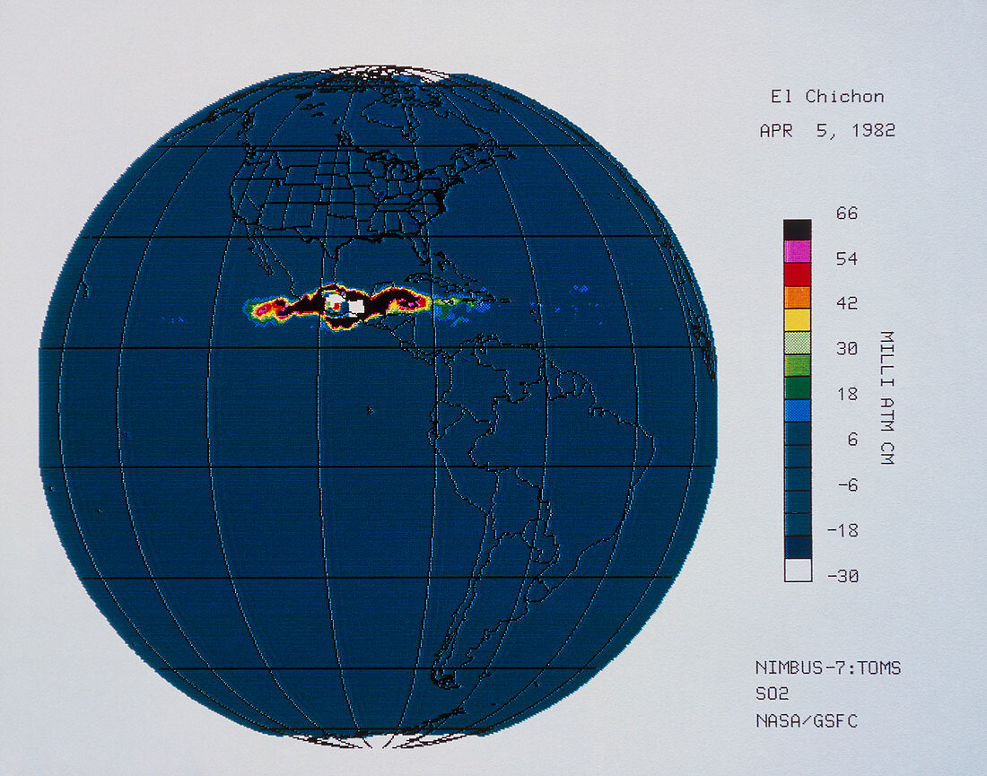
| Satellite image of atmospheric sulphur dioxide (SO2) after the eruption of El Chichon,Yucatan,Mexico. El Chichon erupted on 28 March 1982 & again on the 3rd & 4th of April. This image,the 2nd in a series of 4,relates to data obtained on April 5th by the Total Ozone Mapping Spectrometer (TOMS) on the Nimbus-7 satellite,an instrument normally dedicated to measuring atmospheric ozone. The colour scale at right shows concentration of SO2,with black representing the highest levels. This image shows the SO2 plume's increasing east- west spread; successive images show its enlargement & ultimate dispersal | |
| Lizenzart: | Lizenzpflichtig |
| Credit: | Science Photo Library / GSFC / NASA / LABORATORY FOR ATMOSPHERES |
| Bildgröße: | 3570 px × 2807 px |
| Modell-Rechte: | nicht erforderlich |
| Eigentums-Rechte: | nicht erforderlich |
| Restrictions: | - |
Preise für dieses Bild ab 15 €
Universitäten & Organisationen
(Informationsmaterial Digital, Informationsmaterial Print, Lehrmaterial Digital etc.)
ab 15 €
Redaktionell
(Bücher, Bücher: Sach- und Fachliteratur, Digitale Medien (redaktionell) etc.)
ab 30 €
Werbung
(Anzeigen, Aussenwerbung, Digitale Medien, Fernsehwerbung, Karten, Werbemittel, Zeitschriften etc.)
ab 55 €
Handelsprodukte
(bedruckte Textilie, Kalender, Postkarte, Grußkarte, Verpackung etc.)
ab 75 €
Pauschalpreise
Rechtepakete für die unbeschränkte Bildnutzung in Print oder Online
ab 495 €