Geologists studying GeoProbe model
Bildnummer 11740496
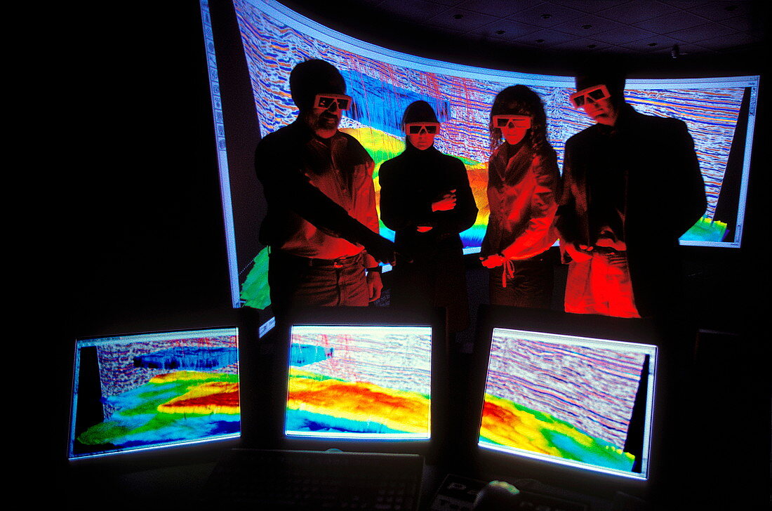
| Geologist studying GeoProbe model. They are wearing glasses to make the model appear three- dimensional. GeoProbe is a software system that models subterranean features to help prospectors find oil and other natural resources. Different colours represent different rock types and formations. GeoProbe combines the data from thousands of seismic probes. A seismic probe creates an artificial mini-earthquake so that geologists can determine the rock types below by studying the pattern of shockwaves generated. GeoProbe has been developed by Magic Earth LLP of Houston,Texas,USA | |
| Lizenzart: | Lizenzpflichtig |
| Credit: | Science Photo Library / Sattlberger, Chris |
| Bildgröße: | 5316 px × 3517 px |
| Modell-Rechte: | nicht erforderlich |
| Eigentums-Rechte: | nicht erforderlich |
| Restrictions: | - |
Preise für dieses Bild ab 15 €
Universitäten & Organisationen
(Informationsmaterial Digital, Informationsmaterial Print, Lehrmaterial Digital etc.)
ab 15 €
Redaktionell
(Bücher, Bücher: Sach- und Fachliteratur, Digitale Medien (redaktionell) etc.)
ab 30 €
Werbung
(Anzeigen, Aussenwerbung, Digitale Medien, Fernsehwerbung, Karten, Werbemittel, Zeitschriften etc.)
ab 55 €
Handelsprodukte
(bedruckte Textilie, Kalender, Postkarte, Grußkarte, Verpackung etc.)
ab 75 €
Pauschalpreise
Rechtepakete für die unbeschränkte Bildnutzung in Print oder Online
ab 495 €
Keywords
- 21. Jahrhundert,
- 3-d,
- Bildschirme,
- Brille,
- Computergrafik,
- Dreidimensional,
- fossile Brennstoffe,
- Gas,
- geografisch,
- Geographie,
- Geologe,
- Geologie,
- geologisch,
- GeoProbe,
- Industrie,
- Industriell,
- Kunstwerk,
- Menschen,
- Modell-,
- Modelling,
- Öl,
- Prospektoren,
- Studium,
- Technologie,
- technologisch,
- Treibstoff,
- Untergrund,
- virtuelle Realität