GeoProbe subterranean model
Bildnummer 11740493
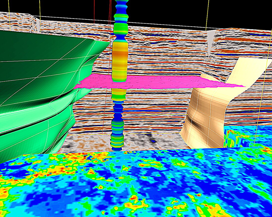
| GeoProbe subterranean model. Three-dimensional model of the subterranean structure of a region as modelled by GeoProbe software. This model is used by prospectors to look for underground deposits of oil and other natural resources. Different colours represent different rock types and formations. GeoProbe combines the data from thousands of seismic probes. A seismic probe creates an artificial mini-earthquake so that geologists can determine the rock types below by studying the pattern of shockwaves generated. GeoProbe has been developed by Magic Earth LLP of Houston,Texas,USA | |
| Lizenzart: | Lizenzpflichtig |
| Credit: | Science Photo Library / Sattlberger, Chris |
| Bildgröße: | 3307 px × 2646 px |
| Modell-Rechte: | nicht erforderlich |
| Eigentums-Rechte: | nicht erforderlich |
| Restrictions: | - |
Preise für dieses Bild ab 15 €
Universitäten & Organisationen
(Informationsmaterial Digital, Informationsmaterial Print, Lehrmaterial Digital etc.)
ab 15 €
Redaktionell
(Bücher, Bücher: Sach- und Fachliteratur, Digitale Medien (redaktionell) etc.)
ab 30 €
Werbung
(Anzeigen, Aussenwerbung, Digitale Medien, Fernsehwerbung, Karten, Werbemittel, Zeitschriften etc.)
ab 55 €
Handelsprodukte
(bedruckte Textilie, Kalender, Postkarte, Grußkarte, Verpackung etc.)
ab 75 €
Pauschalpreise
Rechtepakete für die unbeschränkte Bildnutzung in Print oder Online
ab 495 €