San Andreas fault
Bildnummer 11740386
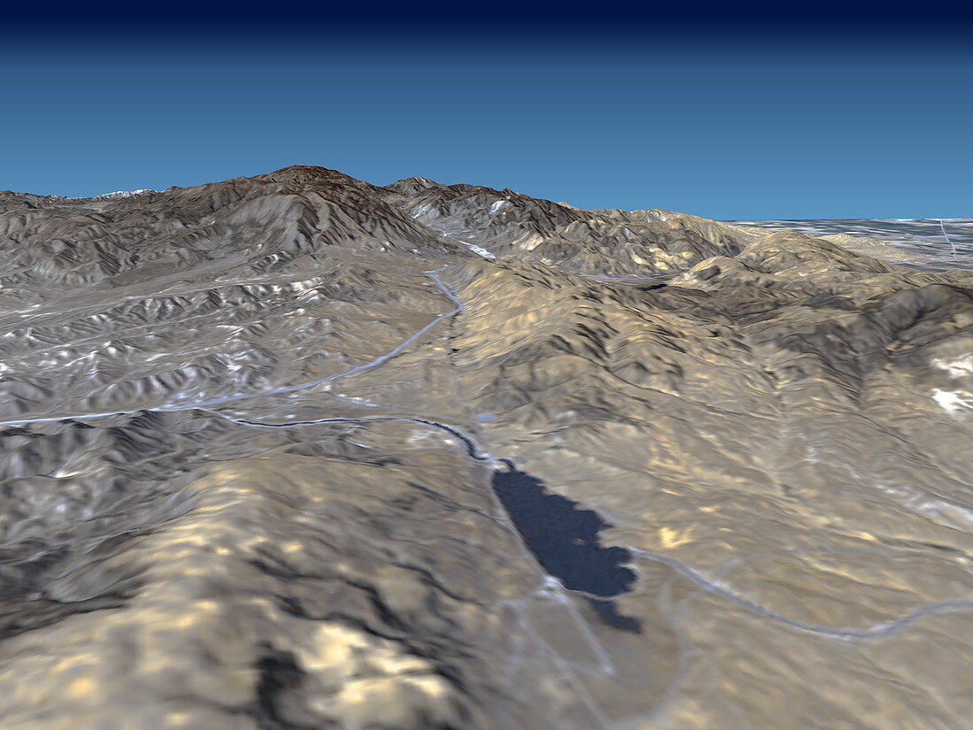
| San Andreas fault. True-colour radar-generated image looking north-west over mountains along the San Andreas fault,California,USA. The Tehachapi mountains (upper right) meet the San Gabriel range of mountains (lower left) at upper left. The Quail Lake Reservoir (dark blue) is at lower centre. The San Andreas fault is the active tectonic boundary between the North American tectonic plate (right) and the Pacific tectonic plate (left). It causes major earthquakes in the region. This image was obtained by draping visual Landsat satellite data over topographical radar data from the Shuttle Radar Topography Mission (SRTM,Space Shuttle Endeavour,February 2000) | |
| Lizenzart: | Lizenzpflichtig |
| Credit: | Science Photo Library / NASA |
| Bildgröße: | 3500 px × 2625 px |
| Modell-Rechte: | nicht erforderlich |
| Eigentums-Rechte: | nicht erforderlich |
| Restrictions: | - |
Preise für dieses Bild ab 15 €
Universitäten & Organisationen
(Informationsmaterial Digital, Informationsmaterial Print, Lehrmaterial Digital etc.)
ab 15 €
Redaktionell
(Bücher, Bücher: Sach- und Fachliteratur, Digitale Medien (redaktionell) etc.)
ab 30 €
Werbung
(Anzeigen, Aussenwerbung, Digitale Medien, Fernsehwerbung, Karten, Werbemittel, Zeitschriften etc.)
ab 55 €
Handelsprodukte
(bedruckte Textilie, Kalender, Postkarte, Grußkarte, Verpackung etc.)
ab 75 €
Pauschalpreise
Rechtepakete für die unbeschränkte Bildnutzung in Print oder Online
ab 495 €