San Andreas fault
Bildnummer 11740385
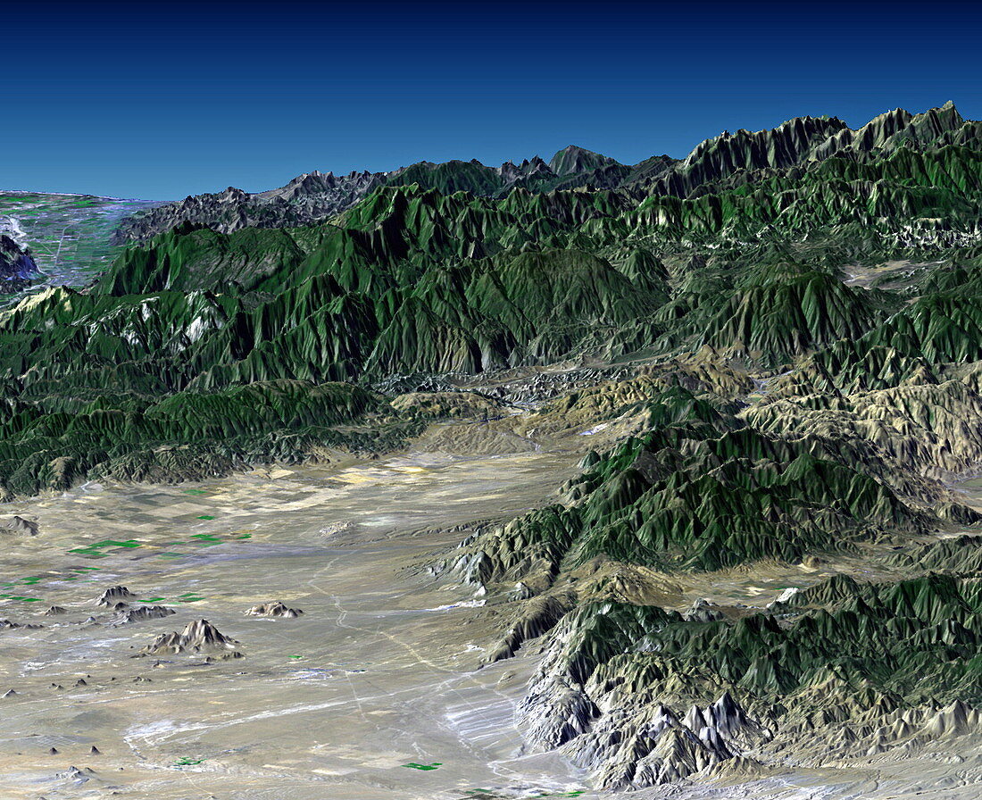
| San Andreas fault. True-colour radar-generated image looking south-west,over Antelope Valley,towards mountain ranges bounding the San Andreas fault,California,USA. This fault runs across the image,forming one of the boundaries of the valley in the foreground. This is Antelope Valley,the westernmost part of the Mojave Desert. The active San Andreas fault causes major earthquakes in the region. The Tehachapi mountains are at lower right. This image was obtained by draping visual Landsat satellite data over topographical radar data from the Shuttle Radar Topography Mission (SRTM,Space Shuttle Endeavour,February 2000) | |
| Lizenzart: | Lizenzpflichtig |
| Credit: | Science Photo Library / NASA |
| Bildgröße: | 1443 px × 1175 px |
| Modell-Rechte: | nicht erforderlich |
| Eigentums-Rechte: | nicht erforderlich |
| Restrictions: | - |
Preise für dieses Bild ab 15 €
Universitäten & Organisationen
(Informationsmaterial Digital, Informationsmaterial Print, Lehrmaterial Digital etc.)
ab 15 €
Redaktionell
(Bücher, Bücher: Sach- und Fachliteratur, Digitale Medien (redaktionell) etc.)
ab 30 €
Werbung
(Anzeigen, Aussenwerbung, Digitale Medien, Fernsehwerbung, Karten, Werbemittel, Zeitschriften etc.)
ab 55 €
Handelsprodukte
(bedruckte Textilie, Kalender, Postkarte, Grußkarte, Verpackung etc.)
ab 75 €
Pauschalpreise
Rechtepakete für die unbeschränkte Bildnutzung in Print oder Online
ab 495 €