Pacific Ring of Fire
Bildnummer 11740370
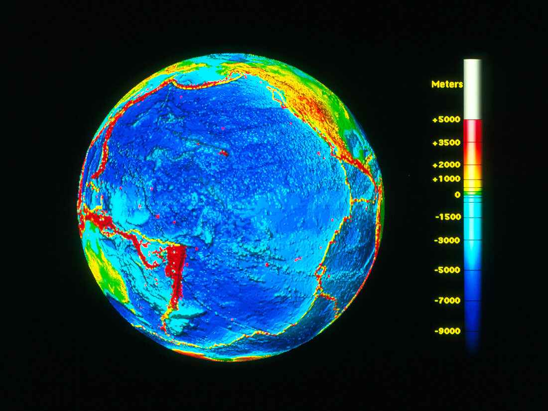
| Pacific Ring of Fire. Computer graphic of the globe showing earthquake zones,known as the Ring of Fire,around the rim of the Pacific Ocean. The depth of the ocean & the elevation of the land is colour-coded using the metre scale at far right. The epicentres of earthquakes with a magnitude on the Richter scale greater than or equal to 5 are marked as red dots. The boundaries between the different plates in the Earth's crust are shown as yellow lines. The earthquake epicentres are mainly around the rim of the Pacific and are caused by the movement of plates in the Earth's crust under the ocean moving against those under the land. Image of earthquakes recorded since 1980 | |
| Lizenzart: | Lizenzpflichtig |
| Credit: | Science Photo Library / US Geological Survey |
| Bildgröße: | 3303 px × 2480 px |
| Modell-Rechte: | nicht erforderlich |
| Eigentums-Rechte: | nicht erforderlich |
| Restrictions: | - |
Preise für dieses Bild ab 15 €
Universitäten & Organisationen
(Informationsmaterial Digital, Informationsmaterial Print, Lehrmaterial Digital etc.)
ab 15 €
Redaktionell
(Bücher, Bücher: Sach- und Fachliteratur, Digitale Medien (redaktionell) etc.)
ab 30 €
Werbung
(Anzeigen, Aussenwerbung, Digitale Medien, Fernsehwerbung, Karten, Werbemittel, Zeitschriften etc.)
ab 55 €
Handelsprodukte
(bedruckte Textilie, Kalender, Postkarte, Grußkarte, Verpackung etc.)
ab 75 €
Pauschalpreise
Rechtepakete für die unbeschränkte Bildnutzung in Print oder Online
ab 495 €