Road cutting through the San Andreas fault
Bildnummer 11740367
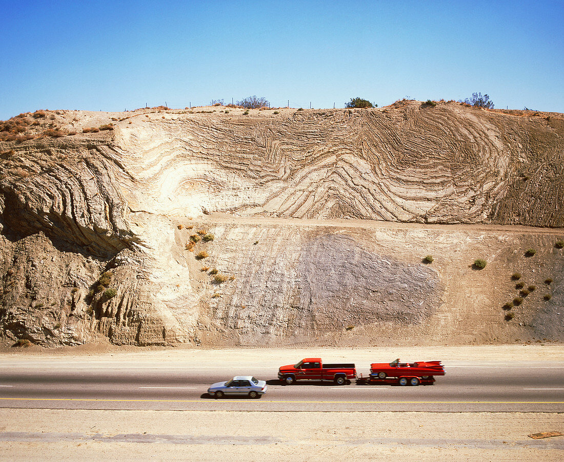
| San Andreas fault. Vehicles on a road cutting through the San Andreas seismic fault in Californ- ia,USA. The strata in the rock which forms the cliff have been twisted and folded by tectonic forces. The fault marks the boundary between the Pacific and North American tectonic plates. The fault is a source of earthquakes because these plates are moving relative to each other. Friction between the rocks on each side of the fault can temporarily prevent local movement. The stress at the fault increases until the friction is overcome and there is a sudden movement of ground which causes an earthquake. Photographed on Highway 14 near Palmdale,California | |
| Lizenzart: | Lizenzpflichtig |
| Credit: | Science Photo Library / Bond, Martin |
| Bildgröße: | 4673 px × 3832 px |
| Modell-Rechte: | nicht erforderlich |
| Eigentums-Rechte: | nicht erforderlich |
| Restrictions: | - |
Preise für dieses Bild ab 15 €
Universitäten & Organisationen
(Informationsmaterial Digital, Informationsmaterial Print, Lehrmaterial Digital etc.)
ab 15 €
Redaktionell
(Bücher, Bücher: Sach- und Fachliteratur, Digitale Medien (redaktionell) etc.)
ab 30 €
Werbung
(Anzeigen, Aussenwerbung, Digitale Medien, Fernsehwerbung, Karten, Werbemittel, Zeitschriften etc.)
ab 55 €
Handelsprodukte
(bedruckte Textilie, Kalender, Postkarte, Grußkarte, Verpackung etc.)
ab 75 €
Pauschalpreise
Rechtepakete für die unbeschränkte Bildnutzung in Print oder Online
ab 495 €