Aerial photograph of San Andreas Fault
Bildnummer 11740355
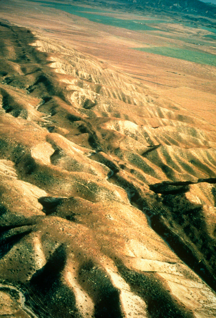
| Aerial photograph of the San Andreas fault as it crosses the Carrizo Plain approximately 450km (300 miles) south of San Francisco & 160km (100 miles) north of Los Angeles. One of the world's great seismic faults,the San Andreas extends almost the full length of California & is responsible for major earthquakes. A linear valley has eroded along the main track of the fault,running from top left to bottom right of the photograph. Cultivated fields on the Carrizo Plain are seen at top right.The desolate landscape consists of pressure ridges formed as a result of hundreds of fault movements. Location: Carrizo Plain area,Sec. 19,T32S,R22E | |
| Lizenzart: | Lizenzpflichtig |
| Credit: | Science Photo Library / US Geological Survey |
| Bildgröße: | 2480 px × 3663 px |
| Modell-Rechte: | nicht erforderlich |
| Eigentums-Rechte: | nicht erforderlich |
| Restrictions: | - |
Preise für dieses Bild ab 15 €
Universitäten & Organisationen
(Informationsmaterial Digital, Informationsmaterial Print, Lehrmaterial Digital etc.)
ab 15 €
Redaktionell
(Bücher, Bücher: Sach- und Fachliteratur, Digitale Medien (redaktionell) etc.)
ab 30 €
Werbung
(Anzeigen, Aussenwerbung, Digitale Medien, Fernsehwerbung, Karten, Werbemittel, Zeitschriften etc.)
ab 55 €
Handelsprodukte
(bedruckte Textilie, Kalender, Postkarte, Grußkarte, Verpackung etc.)
ab 75 €
Pauschalpreise
Rechtepakete für die unbeschränkte Bildnutzung in Print oder Online
ab 495 €