Aerial photo of San Andreas fault
Bildnummer 11740350
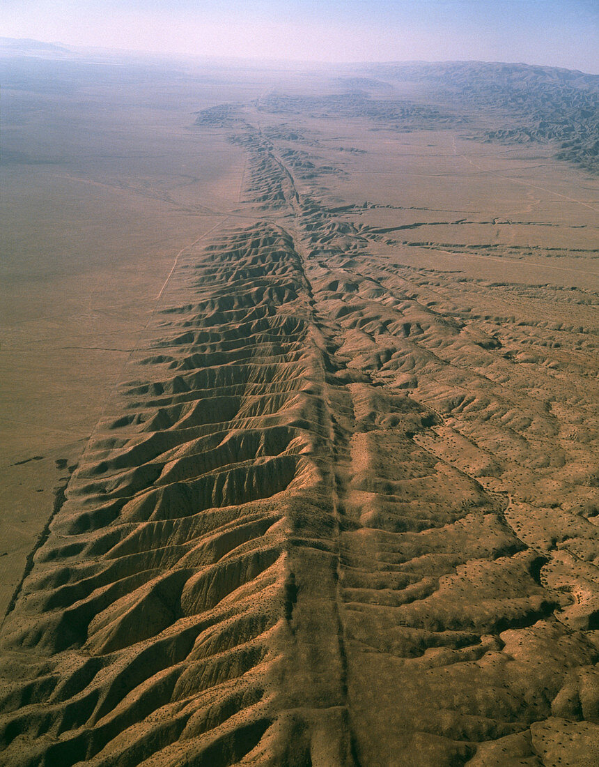
| Aerial photograph of the San Andreas fault as it crosses the Carrizo Plain some 450km (300 miles) south of San Francisco and 160km (100 miles) north of Los Angeles. The fault,which extends almost the full length of California and is responsible for major earthquakes,is the narrow,valley-like scar running from bottom right to top centre of the picture. The desolate landscape consists of pressure ridges formed as a result of hundreds of fault movements. The Carrizo Plain is at left,the elevated Elkhorn Scarp at right. This is the place where the San Andreas fault is at its most spectacular | |
| Lizenzart: | Lizenzpflichtig |
| Credit: | Science Photo Library / Parker, David |
| Bildgröße: | 3331 px × 4261 px |
| Modell-Rechte: | nicht erforderlich |
| Eigentums-Rechte: | nicht erforderlich |
| Restrictions: | - |
Preise für dieses Bild ab 15 €
Universitäten & Organisationen
(Informationsmaterial Digital, Informationsmaterial Print, Lehrmaterial Digital etc.)
ab 15 €
Redaktionell
(Bücher, Bücher: Sach- und Fachliteratur, Digitale Medien (redaktionell) etc.)
ab 30 €
Werbung
(Anzeigen, Aussenwerbung, Digitale Medien, Fernsehwerbung, Karten, Werbemittel, Zeitschriften etc.)
ab 55 €
Handelsprodukte
(bedruckte Textilie, Kalender, Postkarte, Grußkarte, Verpackung etc.)
ab 75 €
Pauschalpreise
Rechtepakete für die unbeschränkte Bildnutzung in Print oder Online
ab 495 €