2007 Chilean earthquake intensity map
Bildnummer 11740343
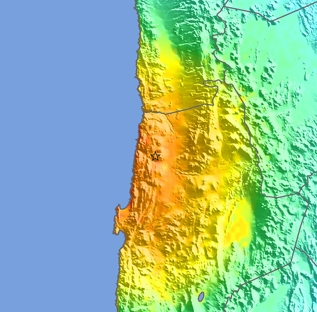
| 2007 Chilean earthquake intensity map. This earthquake struck at 15.40 GMT (12.40 local time) on 14th November 2007 in Antofagasta,Chile. It had a magnitude of 7.7 on the Richter scale and resulted from the release of stresses generated by the subduction (submergence) of the oceanic Nazca plate beneath the South American plate. The earthquake caused at least 2 deaths,injured at least 117 people and disrupted copper mining,Chile being the world's top supplier. The epicentre (marked by the black star) struck at a depth of 60 kilometres,170 kilometres north east of Antofagasta. The colours on the land show the intensity of the shaking,from orange (severe) through yellow (strong) and green (moderate) to blue (weak) | |
| Lizenzart: | Lizenzpflichtig |
| Credit: | Science Photo Library / US Geological Survey |
| Bildgröße: | 4800 px × 4724 px |
| Modell-Rechte: | nicht erforderlich |
| Eigentums-Rechte: | nicht erforderlich |
| Restrictions: | - |
Preise für dieses Bild ab 15 €
Universitäten & Organisationen
(Informationsmaterial Digital, Informationsmaterial Print, Lehrmaterial Digital etc.)
ab 15 €
Redaktionell
(Bücher, Bücher: Sach- und Fachliteratur, Digitale Medien (redaktionell) etc.)
ab 30 €
Werbung
(Anzeigen, Aussenwerbung, Digitale Medien, Fernsehwerbung, Karten, Werbemittel, Zeitschriften etc.)
ab 55 €
Handelsprodukte
(bedruckte Textilie, Kalender, Postkarte, Grußkarte, Verpackung etc.)
ab 75 €
Pauschalpreise
Rechtepakete für die unbeschränkte Bildnutzung in Print oder Online
ab 495 €