2007 Sumatra earthquake intensity map
Bildnummer 11740340
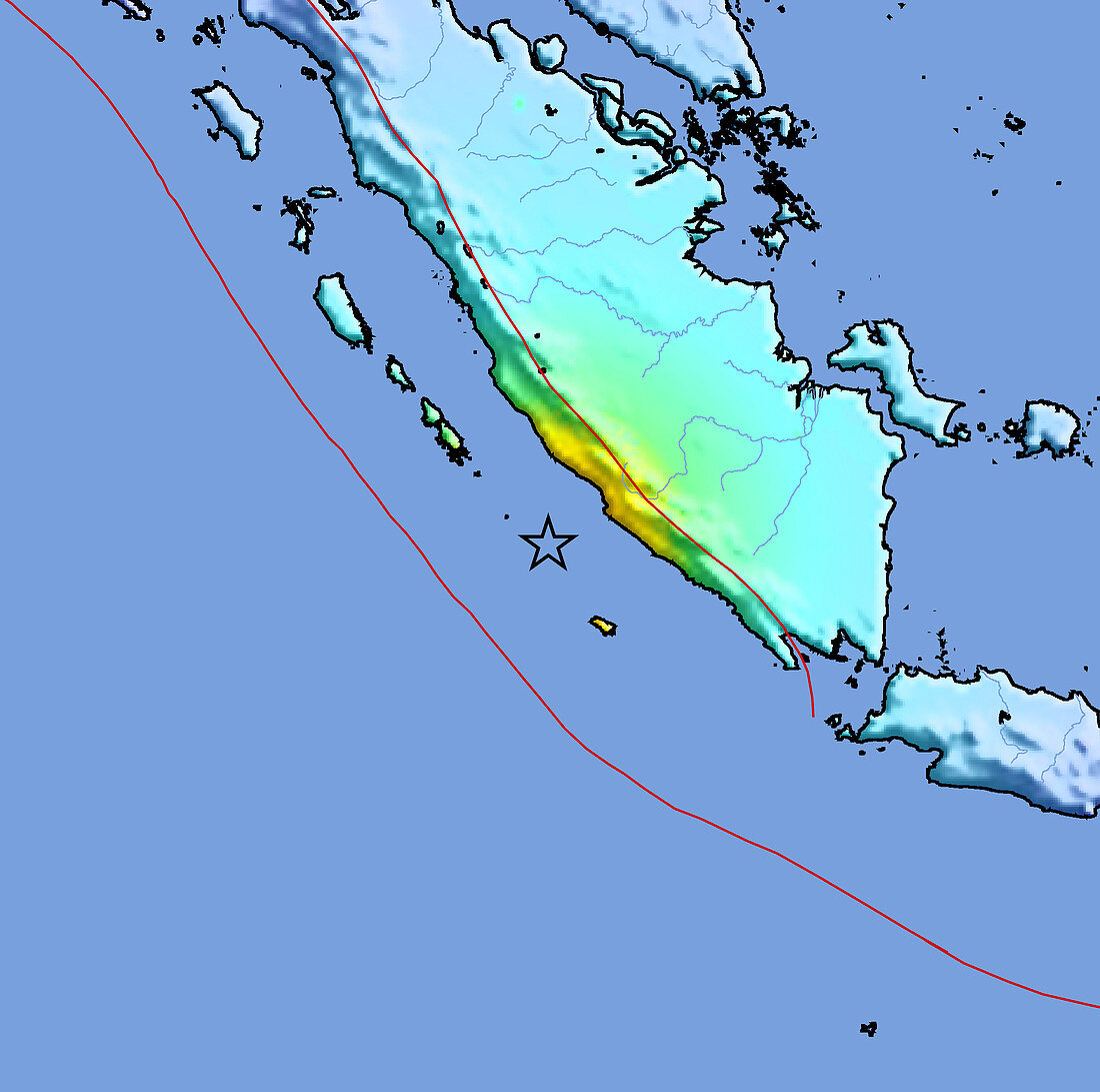
| 2007 Sumatra earthquake intensity map. This earthquake struck at 18.10 local time on 12th September 2007 on the Indonesian island of Sumatra and had a magnitude of 8.2. The earthquake caused buildings to collapse on the west coast of Sumatra,Indonesia,and injured hundreds of people. The Pacific Tsunami Warning Centre issued an alert for the entire Indian Ocean region. The epicentre (marked by the black star) was 30 kilometres below the seabed to the west of Sumatra. The colours on the land show the intensity of the shaking felt,from orange (severe) through yellow (strong) and green (moderate) to blue (weak). The red line diagonally across centre is the fault line between the Indo-Australian and the Sunda tectonic plates | |
| Lizenzart: | Lizenzpflichtig |
| Credit: | Science Photo Library / US Geological Survey |
| Bildgröße: | 3900 px × 3869 px |
| Modell-Rechte: | nicht erforderlich |
| Eigentums-Rechte: | nicht erforderlich |
| Restrictions: | - |
Preise für dieses Bild ab 15 €
Universitäten & Organisationen
(Informationsmaterial Digital, Informationsmaterial Print, Lehrmaterial Digital etc.)
ab 15 €
Redaktionell
(Bücher, Bücher: Sach- und Fachliteratur, Digitale Medien (redaktionell) etc.)
ab 30 €
Werbung
(Anzeigen, Aussenwerbung, Digitale Medien, Fernsehwerbung, Karten, Werbemittel, Zeitschriften etc.)
ab 55 €
Handelsprodukte
(bedruckte Textilie, Kalender, Postkarte, Grußkarte, Verpackung etc.)
ab 75 €
Pauschalpreise
Rechtepakete für die unbeschränkte Bildnutzung in Print oder Online
ab 495 €