2007 Solomon Islands earthquake intensity
Bildnummer 11740338
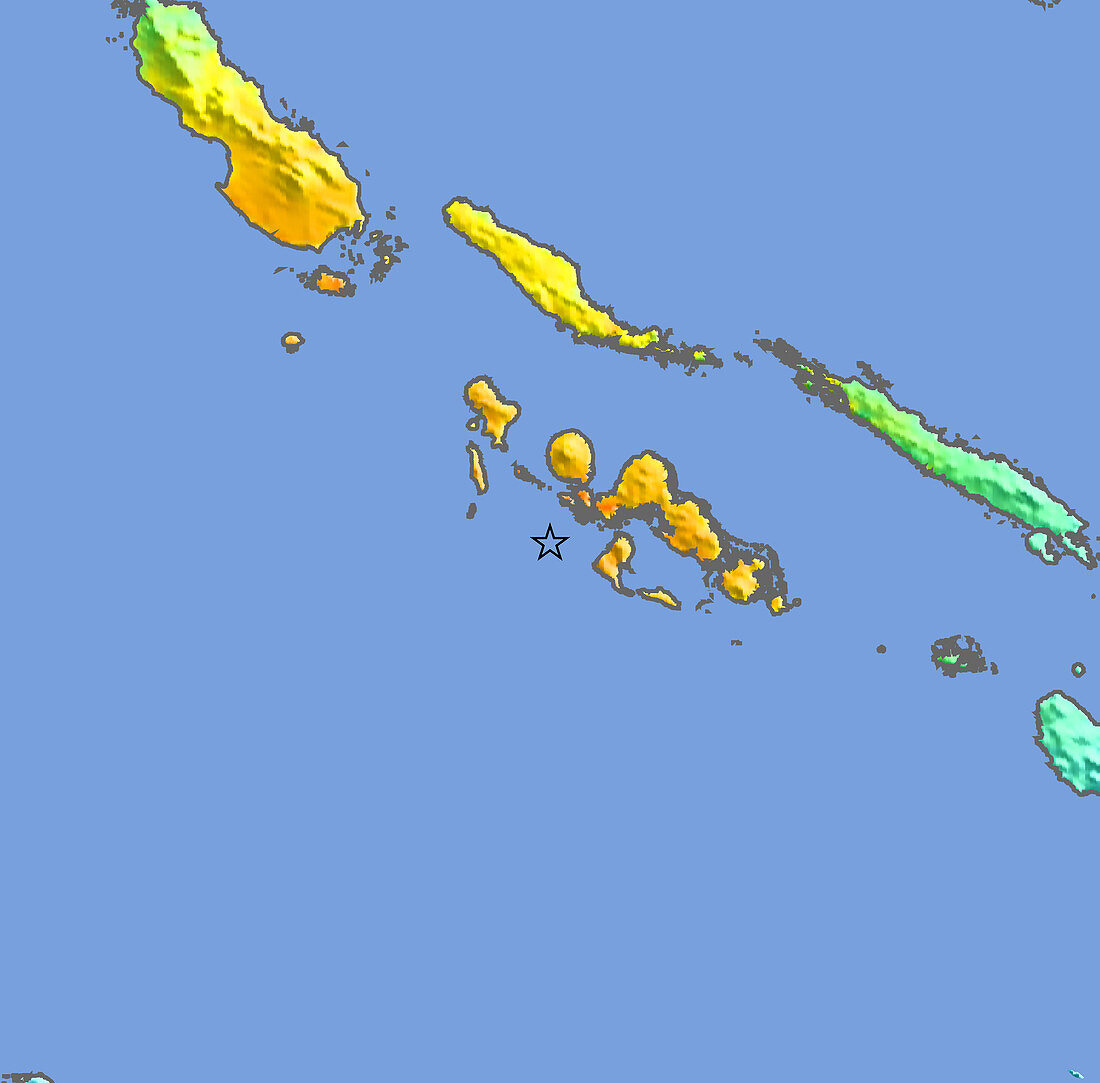
| 2007 Solomon Islands earthquake intensity map. The colours indicate the amount of shaking produced by the earthquake on the land. Blue is weak shaking,green moderate,yellow strong and orange is very strong shaking. The magnitude 8.0 earthquake occurred on 2nd April 2007. Its focus was 10 kilometres below the seabed at the location indicated by the black star (centre),only 20 kilometres from the nearest land. It caused a tsunami that arrived before the official warning,although many people had fled to high ground on feeling the quake. Nonetheless,dozens of people were killed and over 5000 left homeless by the tsunami. The Solomon Islands lie on the boundary of the Pacific tectonic plate,on the so- called Ring of Fire,in which earthquakes and volcanic eruptions are common | |
| Lizenzart: | Lizenzpflichtig |
| Credit: | Science Photo Library / US Geological Survey |
| Bildgröße: | 4862 px × 4786 px |
| Modell-Rechte: | nicht erforderlich |
| Eigentums-Rechte: | nicht erforderlich |
| Restrictions: | - |
Preise für dieses Bild ab 15 €
Universitäten & Organisationen
(Informationsmaterial Digital, Informationsmaterial Print, Lehrmaterial Digital etc.)
ab 15 €
Redaktionell
(Bücher, Bücher: Sach- und Fachliteratur, Digitale Medien (redaktionell) etc.)
ab 30 €
Werbung
(Anzeigen, Aussenwerbung, Digitale Medien, Fernsehwerbung, Karten, Werbemittel, Zeitschriften etc.)
ab 55 €
Handelsprodukte
(bedruckte Textilie, Kalender, Postkarte, Grußkarte, Verpackung etc.)
ab 75 €
Pauschalpreise
Rechtepakete für die unbeschränkte Bildnutzung in Print oder Online
ab 495 €