False col 3d map of part of East Pacific Rise
Bildnummer 11740289
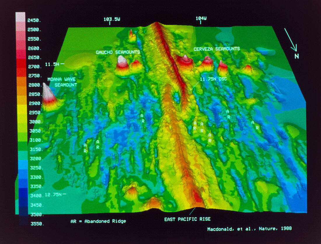
| False-colour,three-dimensional map of part of the East Pacific Rise,showing a discontinuity called an overlapping spreading centre (OSC). The East Pacific Rise (EPR) is a mid ocean ridge lying to the west of Central America. It marks the boundary between the Pacific and Cocos tectonic plates and is a constructive plate boundary or spreading centre where basalt magmas rise to the surface,forming new igneous rock and pushing the older crust away on either side. The OSC comprises two ridge segments,offset by 8km and overlapping by 25km,separated by a 600 metre deep overlap basin. Abandoned ridges and fossil overlap basins surround the OSC. The area shown is 140 x 130 km. For more information see Nature,Vol 335,p217- | |
| Lizenzart: | Lizenzpflichtig |
| Credit: | Science Photo Library / MacDonald, Dr. Ken |
| Bildgröße: | 5359 px × 4089 px |
| Modell-Rechte: | nicht erforderlich |
| Eigentums-Rechte: | nicht erforderlich |
| Restrictions: | - |
Preise für dieses Bild ab 15 €
Universitäten & Organisationen
(Informationsmaterial Digital, Informationsmaterial Print, Lehrmaterial Digital etc.)
ab 15 €
Redaktionell
(Bücher, Bücher: Sach- und Fachliteratur, Digitale Medien (redaktionell) etc.)
ab 30 €
Werbung
(Anzeigen, Aussenwerbung, Digitale Medien, Fernsehwerbung, Karten, Werbemittel, Zeitschriften etc.)
ab 55 €
Handelsprodukte
(bedruckte Textilie, Kalender, Postkarte, Grußkarte, Verpackung etc.)
ab 75 €
Pauschalpreise
Rechtepakete für die unbeschränkte Bildnutzung in Print oder Online
ab 495 €