Sonar of ocean floor off Louisiana,USA
Bildnummer 11740221
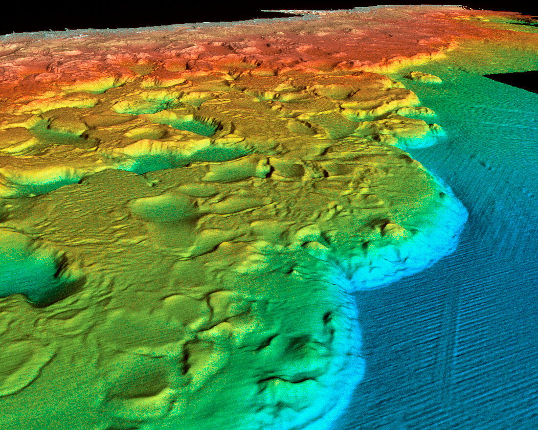
| Sea floor off Louisiana. High-definition coloured sonar image of the continental shelf off the Louisiana coast,USA. This most detailed mapping of the Gulf of Mexico ocean floor off the North American coast was made by ships recording sound echos from the ocean bottom. Colours show depths of the ocean floor: white (near sea level),orange (1000 metres),yellow (2000 m),blue (3000 m). On this continental shelf sediments have been deposited by the Mississippi river. Buried salt and its movement beneath these sediments creates a pock-marked landscape that resembles the moon. The salt arose from evaporation in the Gulf of Mexico | |
| Lizenzart: | Lizenzpflichtig |
| Credit: | Science Photo Library / Haxby, W. / Lamont-Doherty Earth Observatory |
| Bildgröße: | 3542 px × 2830 px |
| Modell-Rechte: | nicht erforderlich |
| Eigentums-Rechte: | nicht erforderlich |
| Restrictions: | - |
Preise für dieses Bild ab 15 €
Universitäten & Organisationen
(Informationsmaterial Digital, Informationsmaterial Print, Lehrmaterial Digital etc.)
ab 15 €
Redaktionell
(Bücher, Bücher: Sach- und Fachliteratur, Digitale Medien (redaktionell) etc.)
ab 30 €
Werbung
(Anzeigen, Aussenwerbung, Digitale Medien, Fernsehwerbung, Karten, Werbemittel, Zeitschriften etc.)
ab 55 €
Handelsprodukte
(bedruckte Textilie, Kalender, Postkarte, Grußkarte, Verpackung etc.)
ab 75 €
Pauschalpreise
Rechtepakete für die unbeschränkte Bildnutzung in Print oder Online
ab 495 €