Mariana trench sea floor topography
Bildnummer 11740201
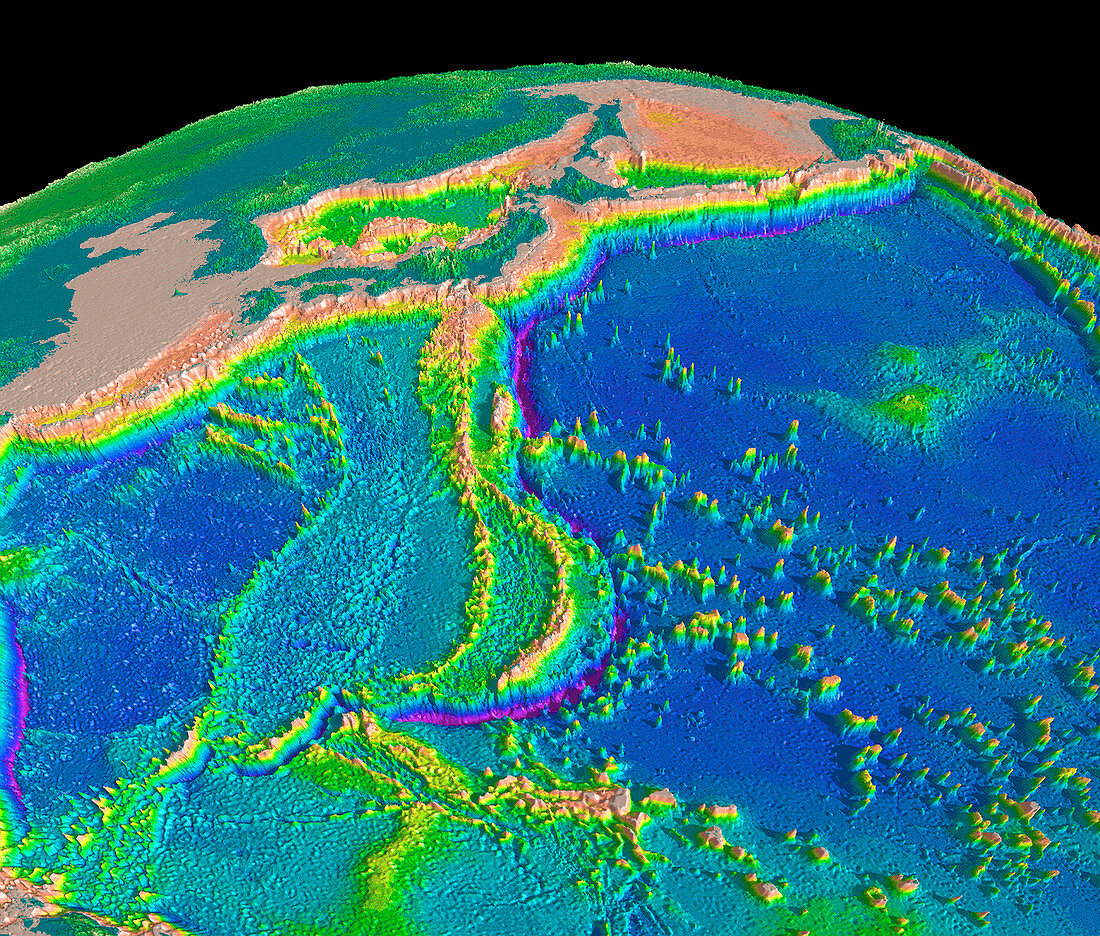
| Mariana trench topography. Computer model of the topography of the region surrounding the Mariana trench (purple arc,lower centre) in the Pacific Ocean,the deepest point on Earth. The model was made by combining data from ship soundings and satellite altimetry. Depth is colour-coded,from red/pink (highest) through yellow,green and blue to purple (lowest). Land is dark green. The islands of Japan are seen at upper centre,with the Korean peninsula to their left. Numerous seamounts,which are of volcanic origin,are seen in the Pacific Ocean at lower right | |
| Lizenzart: | Lizenzpflichtig |
| Credit: | Science Photo Library / US Geological Survey |
| Bildgröße: | 3303 px × 2811 px |
| Modell-Rechte: | nicht erforderlich |
| Eigentums-Rechte: | nicht erforderlich |
| Restrictions: | - |
Preise für dieses Bild ab 15 €
Universitäten & Organisationen
(Informationsmaterial Digital, Informationsmaterial Print, Lehrmaterial Digital etc.)
ab 15 €
Redaktionell
(Bücher, Bücher: Sach- und Fachliteratur, Digitale Medien (redaktionell) etc.)
ab 30 €
Werbung
(Anzeigen, Aussenwerbung, Digitale Medien, Fernsehwerbung, Karten, Werbemittel, Zeitschriften etc.)
ab 55 €
Handelsprodukte
(bedruckte Textilie, Kalender, Postkarte, Grußkarte, Verpackung etc.)
ab 75 €
Pauschalpreise
Rechtepakete für die unbeschränkte Bildnutzung in Print oder Online
ab 495 €