Chesil Beach
Bildnummer 11739966
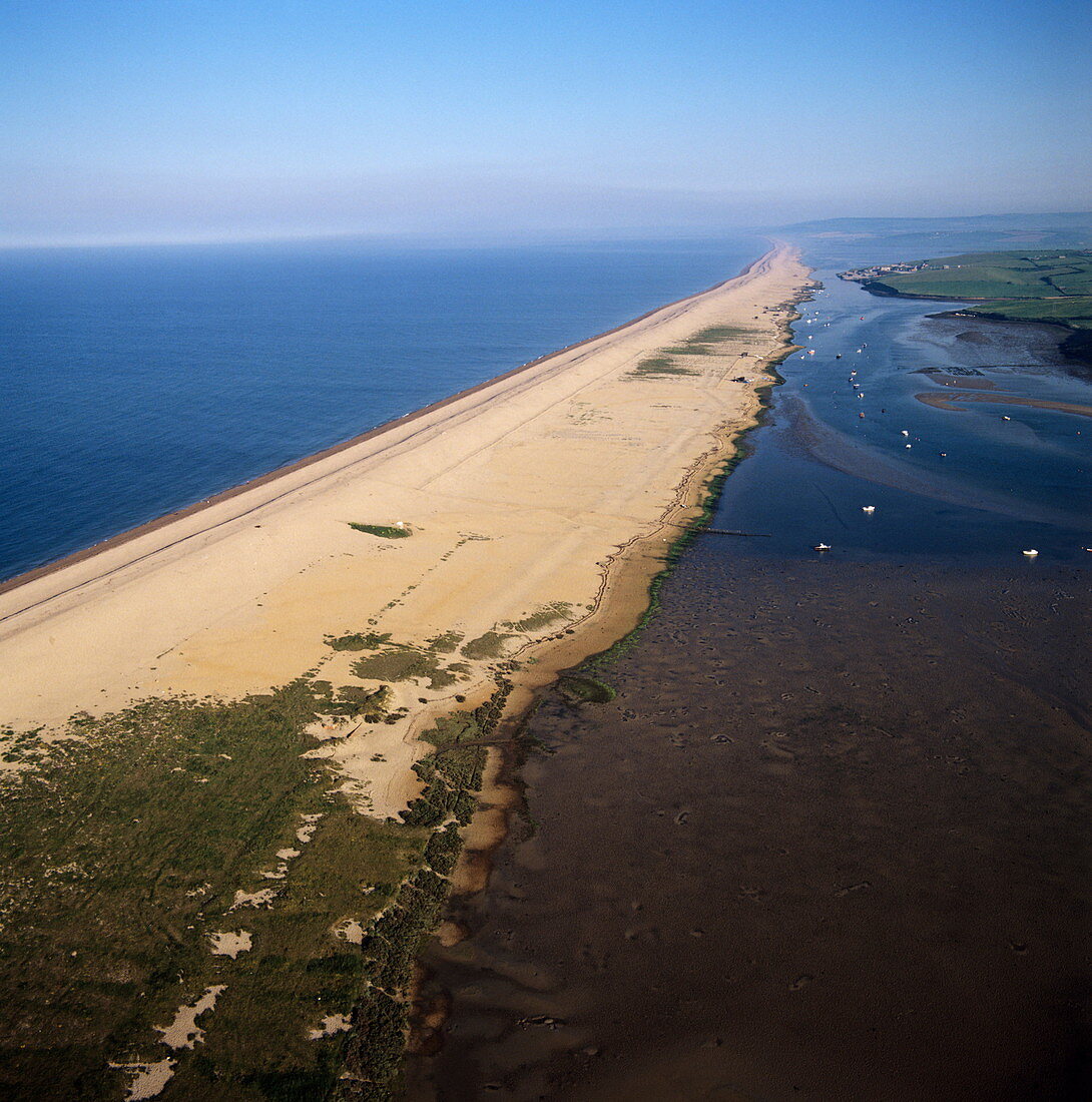
| Chesil Beach,aerial photograph. Chesil Beach is a depositional landform known as a tombolo. It stretches 29km from the mainland at West Bay (Bridport) on the Dorset coast to the Isle of Portland. This view is looking west. The exact evolution of the beach has still not been agreed,though longshore-drift is one theory. Evidence for this is indicated by the grading of the material along the beach,with the smallest pebbles at West Bay and the largest at Portland. The water to right of the beach is a tidal lagoon of brackish water (saline) known as the Fleet,which is an important habitat for wading birds. The sediments within the lagoon are believed to be at least 6- 7000 years old | |
| Lizenzart: | Lizenzpflichtig |
| Credit: | Science Photo Library / Skyscan |
| Bildgröße: | 4170 px × 4210 px |
| Modell-Rechte: | nicht erforderlich |
| Eigentums-Rechte: | nicht erforderlich |
| Restrictions: | - |
Preise für dieses Bild ab 15 €
Universitäten & Organisationen
(Informationsmaterial Digital, Informationsmaterial Print, Lehrmaterial Digital etc.)
ab 15 €
Redaktionell
(Bücher, Bücher: Sach- und Fachliteratur, Digitale Medien (redaktionell) etc.)
ab 30 €
Werbung
(Anzeigen, Aussenwerbung, Digitale Medien, Fernsehwerbung, Karten, Werbemittel, Zeitschriften etc.)
ab 55 €
Handelsprodukte
(bedruckte Textilie, Kalender, Postkarte, Grußkarte, Verpackung etc.)
ab 75 €
Pauschalpreise
Rechtepakete für die unbeschränkte Bildnutzung in Print oder Online
ab 495 €