Coloured sea level map showing La Nina event
Bildnummer 11739668
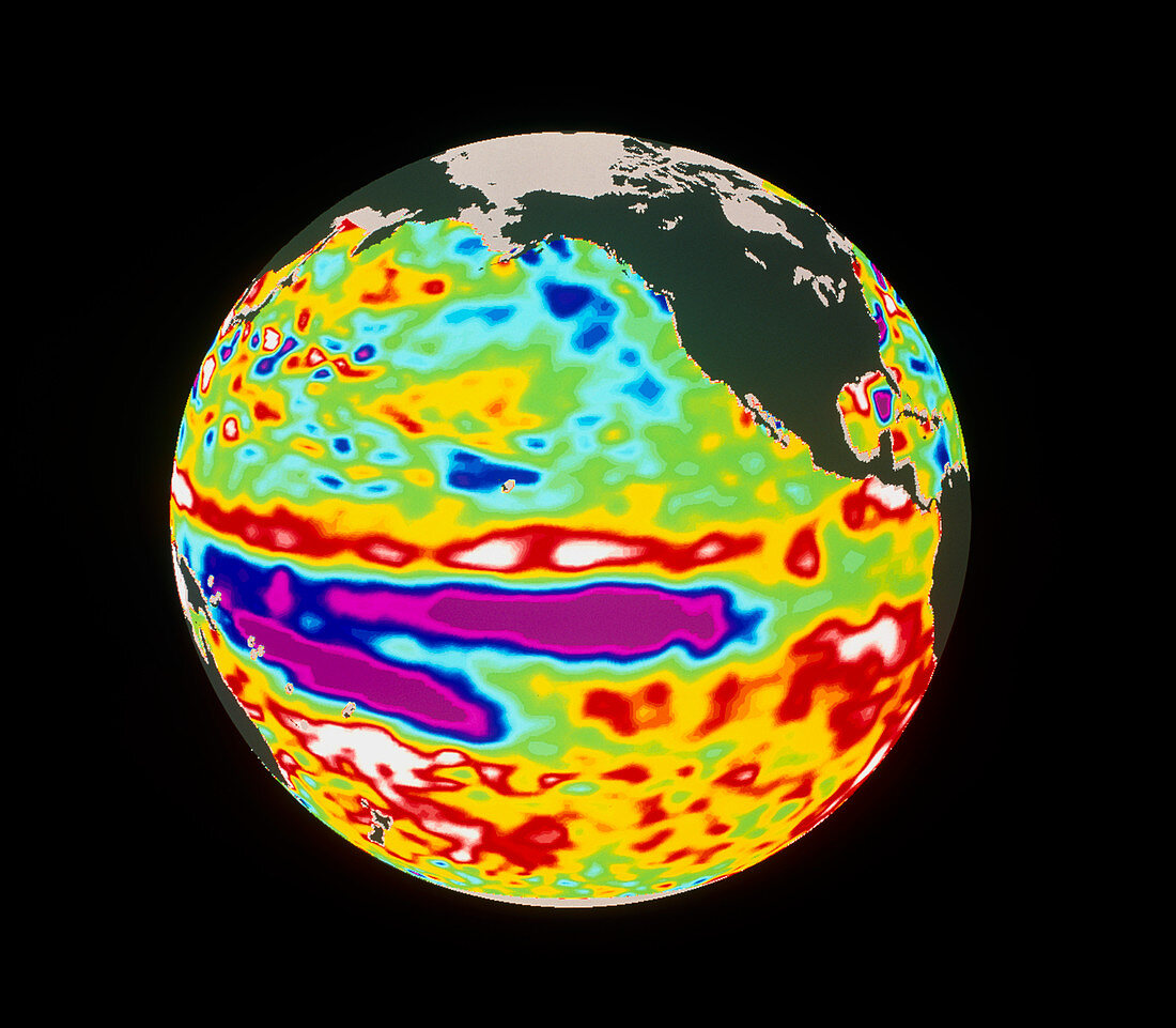
| La Nina event. Coloured satellite map of the Pacific Ocean showing a La Nina event (purple). This image was taken on 11 July 1998. Areas with a lower sea level than average are blue/purple (generally meaning they are cold). Higher areas are red/white. The La Nina event is a large body of relatively cool water which can influence weather systems throughout the world. Above the La Nina system is the remnant of the complimentary El Nino event (red/white),which dominated the eastern Pacific Ocean in 1997/98. The Pacific Ocean varies between El Nino and La Nina events with no fixed cycle. This image was created using data from the US/French TOPEX/Poseidon satellite | |
| Lizenzart: | Lizenzpflichtig |
| Credit: | Science Photo Library / NASA |
| Bildgröße: | 4773 px × 4169 px |
| Modell-Rechte: | nicht erforderlich |
| Eigentums-Rechte: | nicht erforderlich |
| Restrictions: | - |
Preise für dieses Bild ab 15 €
Universitäten & Organisationen
(Informationsmaterial Digital, Informationsmaterial Print, Lehrmaterial Digital etc.)
ab 15 €
Redaktionell
(Bücher, Bücher: Sach- und Fachliteratur, Digitale Medien (redaktionell) etc.)
ab 30 €
Werbung
(Anzeigen, Aussenwerbung, Digitale Medien, Fernsehwerbung, Karten, Werbemittel, Zeitschriften etc.)
ab 55 €
Handelsprodukte
(bedruckte Textilie, Kalender, Postkarte, Grußkarte, Verpackung etc.)
ab 75 €
Pauschalpreise
Rechtepakete für die unbeschränkte Bildnutzung in Print oder Online
ab 495 €