1997 El Nino Pacific sea levels and temperatures
Bildnummer 11739664
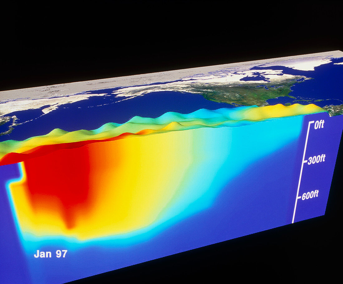
| Early El Nino. Computer artwork based on satellite data of sea level and temperature in the Pacific in January 1997 during the early part of an El Nino event. North is towards upper left,with the Americas at upper right and Asia at upper left. The three-dimensional sea relief map shows higher sea levels (not to scale) in the west. It was created using NASA TOPEX satellite imagery. Sea temperatures,from NOAA's AVHRR satellite sensor and TAO sea moorings,vary from red (30 degrees celsius) in the west to dark blue (8 degrees celsius). El Nino occurs when a warm tongue of water moves into the eastern Pacific,seriously affecting global weather patterns | |
| Lizenzart: | Lizenzpflichtig |
| Credit: | Science Photo Library / NASA |
| Bildgröße: | 4947 px × 4087 px |
| Modell-Rechte: | nicht erforderlich |
| Eigentums-Rechte: | nicht erforderlich |
| Restrictions: | - |
Preise für dieses Bild ab 15 €
Universitäten & Organisationen
(Informationsmaterial Digital, Informationsmaterial Print, Lehrmaterial Digital etc.)
ab 15 €
Redaktionell
(Bücher, Bücher: Sach- und Fachliteratur, Digitale Medien (redaktionell) etc.)
ab 30 €
Werbung
(Anzeigen, Aussenwerbung, Digitale Medien, Fernsehwerbung, Karten, Werbemittel, Zeitschriften etc.)
ab 55 €
Handelsprodukte
(bedruckte Textilie, Kalender, Postkarte, Grußkarte, Verpackung etc.)
ab 75 €
Pauschalpreise
Rechtepakete für die unbeschränkte Bildnutzung in Print oder Online
ab 495 €