Topography of the world's ocean surface
Bildnummer 11739619
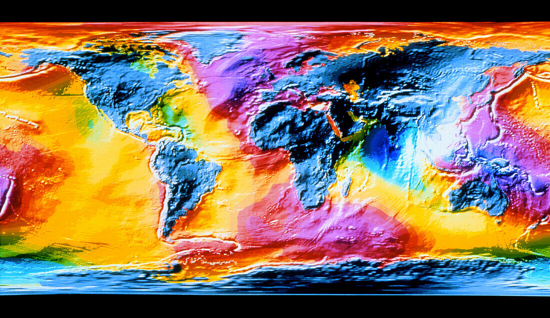
| Global ocean surface topography. Map of the world,showing the topography of the ocean surface. The colours in the image represent the variation in mean sea height; from purple (higher) through red,orange,yellow (no variation),and green to blue (lower). These data are laid over a topographic map of the globe,with ocean floor features shown in shaded relief. Land masses are shown in grey. Variations from mean global sea surface may be caused by extremes of mean atmospheric pressure and local variations in the Earth's gravity field. The data for this image were gathered by the European ERS-1 radar mapping satellite | |
| Lizenzart: | Lizenzpflichtig |
| Credit: | Science Photo Library / ESA / DLR |
| Bildgröße: | 4286 px × 2480 px |
| Modell-Rechte: | nicht erforderlich |
| Eigentums-Rechte: | nicht erforderlich |
| Restrictions: | - |
Preise für dieses Bild ab 15 €
Universitäten & Organisationen
(Informationsmaterial Digital, Informationsmaterial Print, Lehrmaterial Digital etc.)
ab 15 €
Redaktionell
(Bücher, Bücher: Sach- und Fachliteratur, Digitale Medien (redaktionell) etc.)
ab 30 €
Werbung
(Anzeigen, Aussenwerbung, Digitale Medien, Fernsehwerbung, Karten, Werbemittel, Zeitschriften etc.)
ab 55 €
Handelsprodukte
(bedruckte Textilie, Kalender, Postkarte, Grußkarte, Verpackung etc.)
ab 75 €
Pauschalpreise
Rechtepakete für die unbeschränkte Bildnutzung in Print oder Online
ab 495 €