Vatnajokull Glacier,satellite image
Bildnummer 11739440
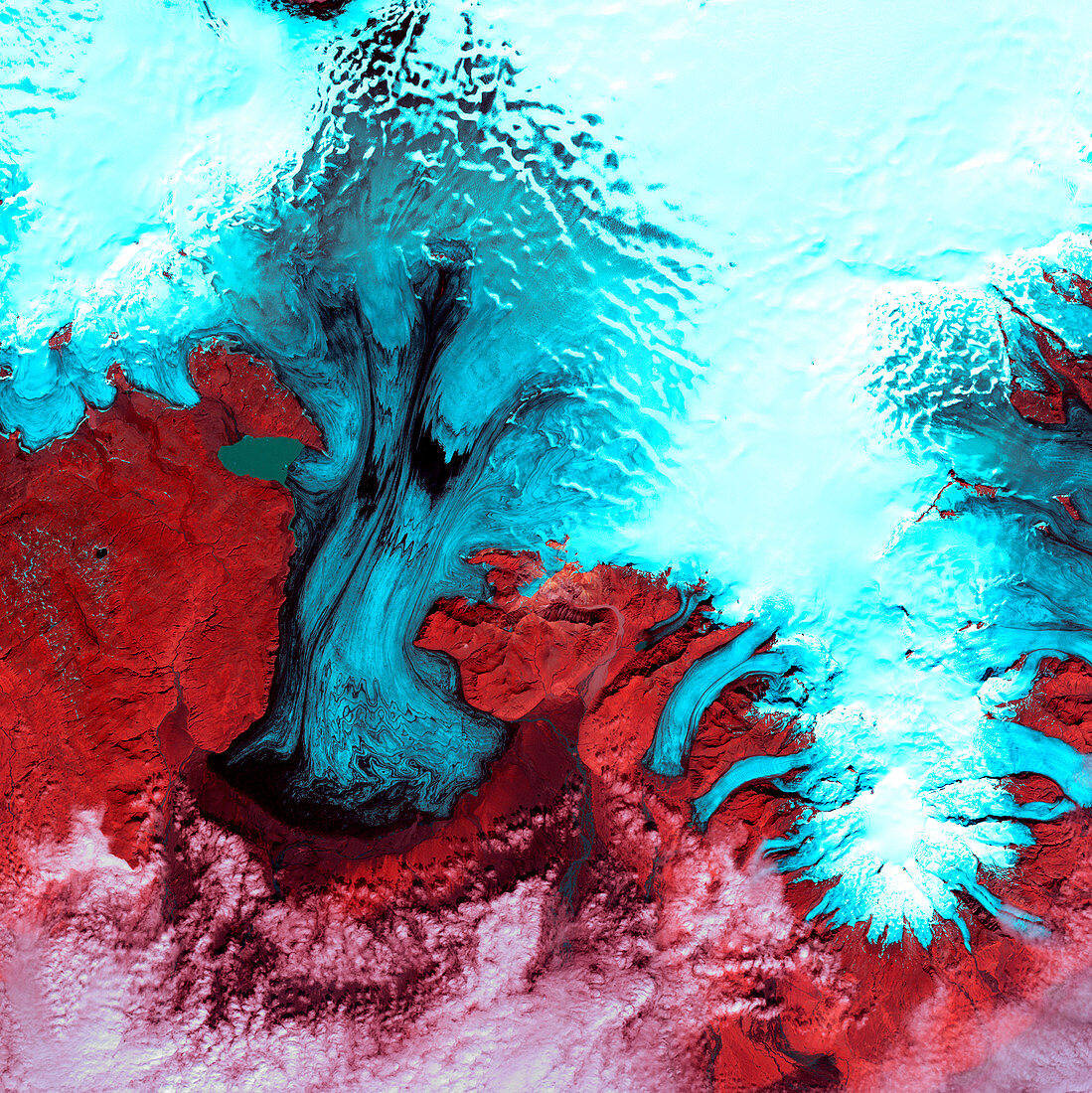
| Vatnajokull Glacier,satellite image. North is at top. Vegetation is red,snow is white and ice is blue. Clouds (white) are seen across bottom. This is the southern part of Vatnajokull Glacier in Iceland's Skaftafell National Park. The 'glacier' is Europe's largest icecap. True glaciers are seen here,as tongues of ice (blue) flowing down from the icecap to lower levels where they melt. Off the edge of the image,at lower right,is the coast,where the glaciers are producing icebergs. The area shown in this image is around 60 kilometres wide. The image data includes infrared wavelengths,and was obtained on 4 August 1999,by the Landsat 7 satellite | |
| Lizenzart: | Lizenzpflichtig |
| Credit: | Science Photo Library / NASA |
| Bildgröße: | 4800 px × 4805 px |
| Modell-Rechte: | nicht erforderlich |
| Eigentums-Rechte: | nicht erforderlich |
| Restrictions: | - |
Preise für dieses Bild ab 15 €
Universitäten & Organisationen
(Informationsmaterial Digital, Informationsmaterial Print, Lehrmaterial Digital etc.)
ab 15 €
Redaktionell
(Bücher, Bücher: Sach- und Fachliteratur, Digitale Medien (redaktionell) etc.)
ab 30 €
Werbung
(Anzeigen, Aussenwerbung, Digitale Medien, Fernsehwerbung, Karten, Werbemittel, Zeitschriften etc.)
ab 55 €
Handelsprodukte
(bedruckte Textilie, Kalender, Postkarte, Grußkarte, Verpackung etc.)
ab 75 €
Pauschalpreise
Rechtepakete für die unbeschränkte Bildnutzung in Print oder Online
ab 495 €