Malaspina Glacier,Alaska
Bildnummer 11739392
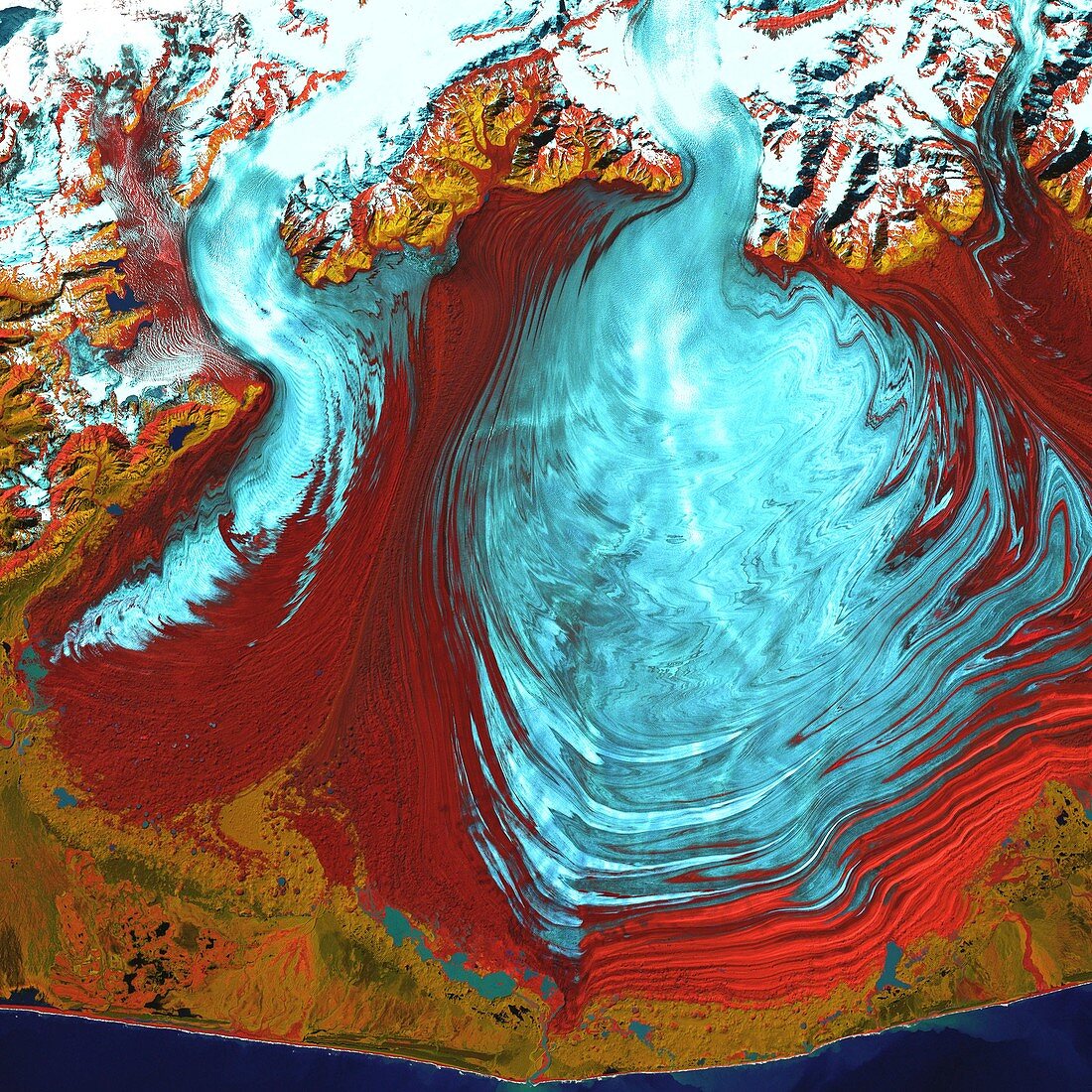
| Malaspina Glacier,Alaska,USA,satellite image. The glacial ice (blue) has spread out to form a large rounded shape (centre right). The ice flowed down from the snow-covered mountains (across top,white),to spread out over the lowland area (red). This is an example of a piedmont glacier. Another glacier is seen at upper left. The ice is flowing downhill towards the coast (along bottom). The Malaspina Glacier lies west of Yakutat Bay on the Pacific coast near the Alaska-Canada border. The glacier covers an area of 3880 square kilometres. Image acquired in visible and infrared wavelengths on 31 August 2000 by the Enhanced Thematic Mapper Plus (ETM+) sensor on NASA's Landsat 7 satellite | |
| Lizenzart: | Lizenzpflichtig |
| Credit: | Science Photo Library / NASA |
| Bildgröße: | 3700 px × 3700 px |
| Modell-Rechte: | nicht erforderlich |
| Eigentums-Rechte: | nicht erforderlich |
| Restrictions: | - |
Preise für dieses Bild ab 15 €
Universitäten & Organisationen
(Informationsmaterial Digital, Informationsmaterial Print, Lehrmaterial Digital etc.)
ab 15 €
Redaktionell
(Bücher, Bücher: Sach- und Fachliteratur, Digitale Medien (redaktionell) etc.)
ab 30 €
Werbung
(Anzeigen, Aussenwerbung, Digitale Medien, Fernsehwerbung, Karten, Werbemittel, Zeitschriften etc.)
ab 55 €
Handelsprodukte
(bedruckte Textilie, Kalender, Postkarte, Grußkarte, Verpackung etc.)
ab 75 €
Pauschalpreise
Rechtepakete für die unbeschränkte Bildnutzung in Print oder Online
ab 495 €
Keywords
- 1,
- 2000,
- Alaska,
- Amerika,
- Amerikanisch,
- August,
- Bewegung,
- Eis,
- Erdbeobachtung,
- etm,
- Fließen,
- Gefroren,
- geografisch,
- Geographie,
- Glaziologie,
- infrarot,
- Küste,
- Küstenlinie,
- Landsat 7,
- optisch,
- Satellit,
- Schnee,
- Sichtbar,
- topografisch,
- Topographie,
- topographisch,
- Umwelt,
- uns,
- USA,
- Vereinigte Staaten,
- Weltall