Kamchatka coast,satellite image
Bildnummer 11739242
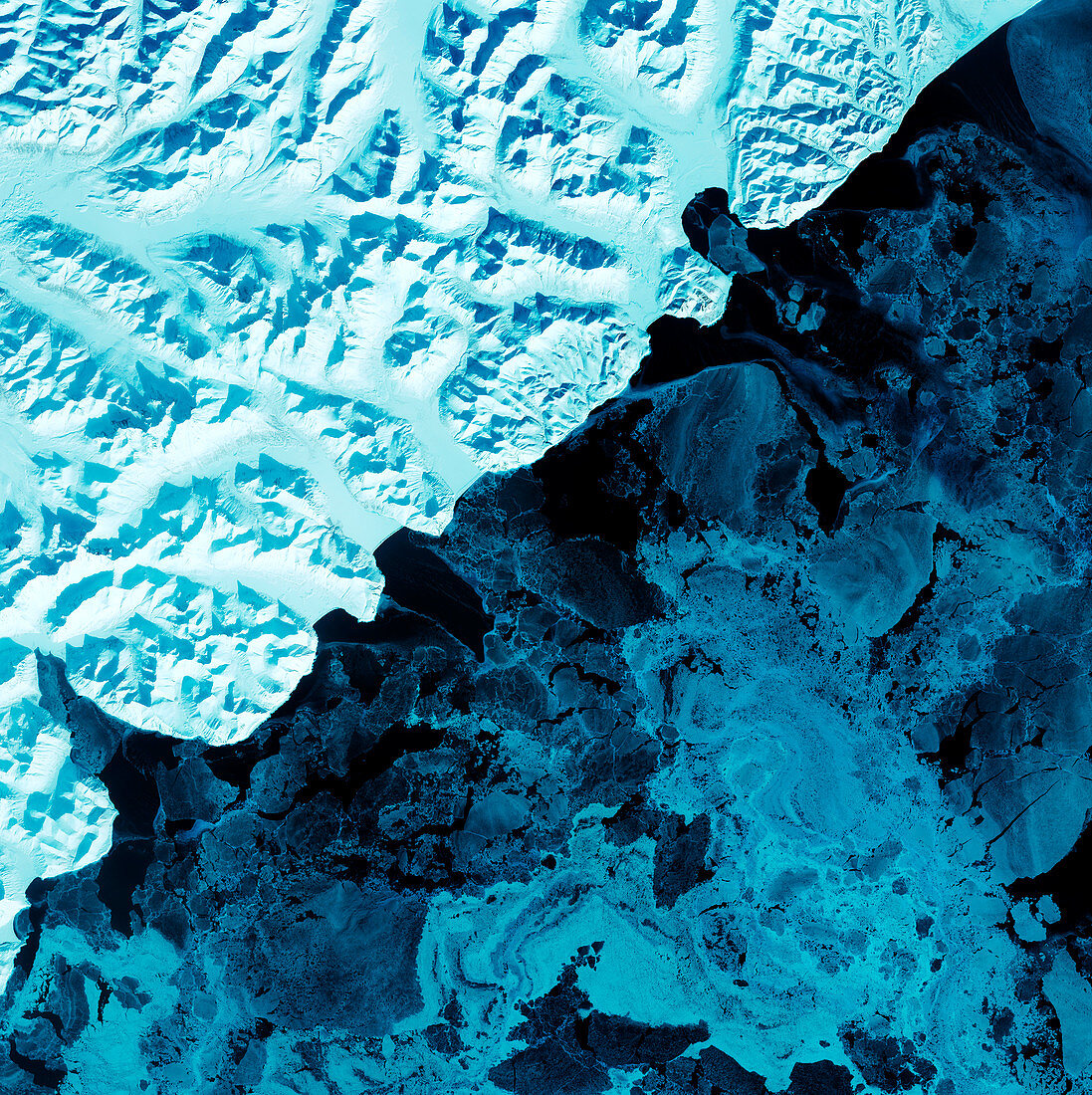
| Kamchatka coast,satellite image. North is at top. Snow and land ice is white,sea ice is blue,and water is black. This is an area on the eastern side of Russia's Kamchatka Peninsula,on its Pacific coast. The ice-covered landscape is volcanic,with numerous active volcanos among the mountain peaks. In between the mountains,glaciers flow down the valleys and form icebergs when they reach the sea. The area shown in this image is around 60 kilometres wide. The image data includes infrared wavelengths,and was obtained on 17 February 2002,using the ASTER sensor on the Terra satellite | |
| Lizenzart: | Lizenzpflichtig |
| Credit: | Science Photo Library / NASA |
| Bildgröße: | 4800 px × 4811 px |
| Modell-Rechte: | nicht erforderlich |
| Eigentums-Rechte: | nicht erforderlich |
| Restrictions: | - |
Preise für dieses Bild ab 15 €
Universitäten & Organisationen
(Informationsmaterial Digital, Informationsmaterial Print, Lehrmaterial Digital etc.)
ab 15 €
Redaktionell
(Bücher, Bücher: Sach- und Fachliteratur, Digitale Medien (redaktionell) etc.)
ab 30 €
Werbung
(Anzeigen, Aussenwerbung, Digitale Medien, Fernsehwerbung, Karten, Werbemittel, Zeitschriften etc.)
ab 55 €
Handelsprodukte
(bedruckte Textilie, Kalender, Postkarte, Grußkarte, Verpackung etc.)
ab 75 €
Pauschalpreise
Rechtepakete für die unbeschränkte Bildnutzung in Print oder Online
ab 495 €
Keywords
- 1,
- 2000er Jahre,
- 21. Jahrhundert,
- Asiatisch,
- Asien,
- Aster,
- Berg,
- Eis,
- eisig,
- Erdbeobachtung,
- Erdkunde,
- Februar,
- Gefroren,
- geografisch,
- Geographie,
- Glaziologie,
- infrarot,
- ir,
- Küste,
- Küsten-,
- Küstenlinie,
- Land,
- Marine,
- Meer,
- Meereis,
- montan,
- Natur,
- Pazifik,
- Reflexionsradiometer,
- Russisch,
- Russland,
- Satellit,
- Satellitenbild,
- Schnee,
- Terra,
- Umwelt,
- Vulkan,
- vulkanisch,
- Vulkanologie,
- Weltall,
- Winter