Researcher uses a Global Positioning Receiver
Bildnummer 11738968
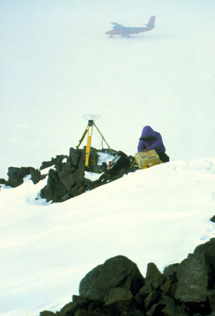
| Antarctic expedition. Antarctic researcher uses a Global Positioning System (GPS) receiver to obtain a measurement of his position as the weather worsens. The receiving antenna is on a tripod,whilst a De Havilland Twin Otter aircraft waits in the background. The receiver calculates the user's position by measuring the time it takes for signals to arrive from GPS satellites at different points of the sky. By combining many readings the receiver's position may be fixed to within a few centimetres. Photograph of a Trimble 4000 SSE GPS receiver | |
| Lizenzart: | Lizenzpflichtig |
| Credit: | Science Photo Library / Vaughan, David |
| Bildgröße: | 2200 px × 3241 px |
| Modell-Rechte: | nicht erforderlich |
| Eigentums-Rechte: | nicht erforderlich |
| Restrictions: | - |
Preise für dieses Bild ab 15 €
Universitäten & Organisationen
(Informationsmaterial Digital, Informationsmaterial Print, Lehrmaterial Digital etc.)
ab 15 €
Redaktionell
(Bücher, Bücher: Sach- und Fachliteratur, Digitale Medien (redaktionell) etc.)
ab 30 €
Werbung
(Anzeigen, Aussenwerbung, Digitale Medien, Fernsehwerbung, Karten, Werbemittel, Zeitschriften etc.)
ab 55 €
Handelsprodukte
(bedruckte Textilie, Kalender, Postkarte, Grußkarte, Verpackung etc.)
ab 75 €
Pauschalpreise
Rechtepakete für die unbeschränkte Bildnutzung in Print oder Online
ab 495 €