California wildfires,October 2007
Bildnummer 11738548
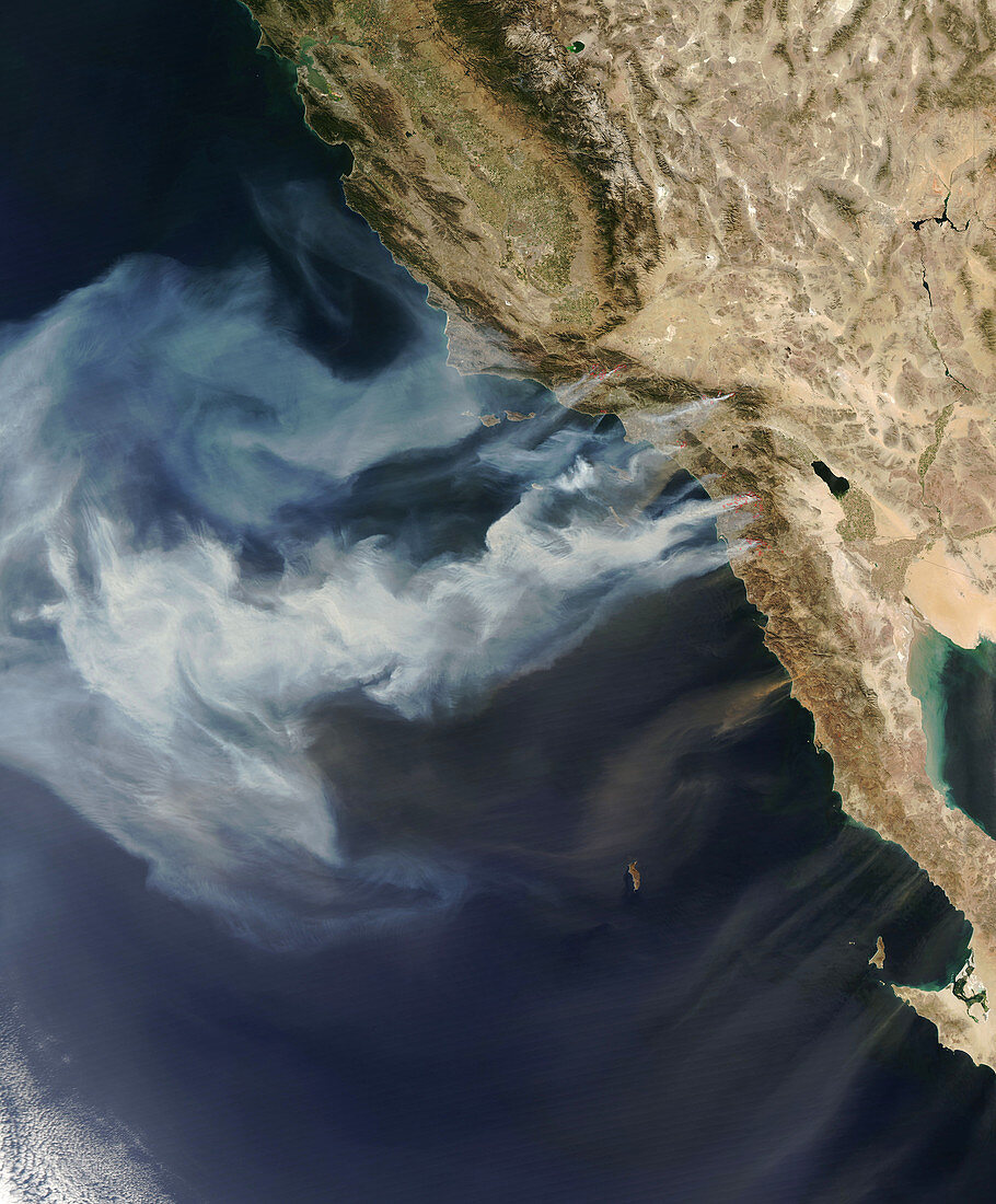
| California wildfires. Satellite image showing active fire zones (red) and smoke plumes from the massive fires across southern California,USA,which began on 21st October 2007. The fires,stretching from Santa Barbara County to the Mexican border,caused six fatalities and at least 70 injuries (as of 24th October). Nearly one million residents had to be evacuated and over 1,600 homes and structures were destroyed. The major factors in the widespread nature of the fires was drought and unusually strong Santa Ana winds. Photographed on 22nd October 2007 at 2100 GMT | |
| Lizenzart: | Lizenzpflichtig |
| Credit: | Science Photo Library / NASA |
| Bildgröße: | 4800 px × 5800 px |
| Modell-Rechte: | nicht erforderlich |
| Eigentums-Rechte: | nicht erforderlich |
| Restrictions: | - |
Preise für dieses Bild ab 15 €
Universitäten & Organisationen
(Informationsmaterial Digital, Informationsmaterial Print, Lehrmaterial Digital etc.)
ab 15 €
Redaktionell
(Bücher, Bücher: Sach- und Fachliteratur, Digitale Medien (redaktionell) etc.)
ab 30 €
Werbung
(Anzeigen, Aussenwerbung, Digitale Medien, Fernsehwerbung, Karten, Werbemittel, Zeitschriften etc.)
ab 55 €
Handelsprodukte
(bedruckte Textilie, Kalender, Postkarte, Grußkarte, Verpackung etc.)
ab 75 €
Pauschalpreise
Rechtepakete für die unbeschränkte Bildnutzung in Print oder Online
ab 495 €
Keywords
- 21. Jahrhundert,
- Amerikanisch,
- atmosphärisch,
- Dürre,
- Erdbeobachtung,
- Feuer,
- geografisch,
- Geographie,
- Kalifornien,
- Katastrophe,
- Küste,
- Küsten-,
- Land,
- massiv,
- Meer,
- Meteorologie,
- meteorologisch,
- Nordamerika,
- nordamerikanisch,
- Oktober,
- Pazifik,
- Rauch,
- Rauchen,
- Satellit,
- Satellitenbild,
- Schaden,
- Umwelt,
- uns,
- USA,
- Verbrennung,
- Vereinigte Staaten,
- Verwüstung,
- Waldbrände,
- Weltall,
- Western,
- Wetter,
- wild,
- Zonen