Satellite image of Brazilian forest fire,1998
Bildnummer 11738482
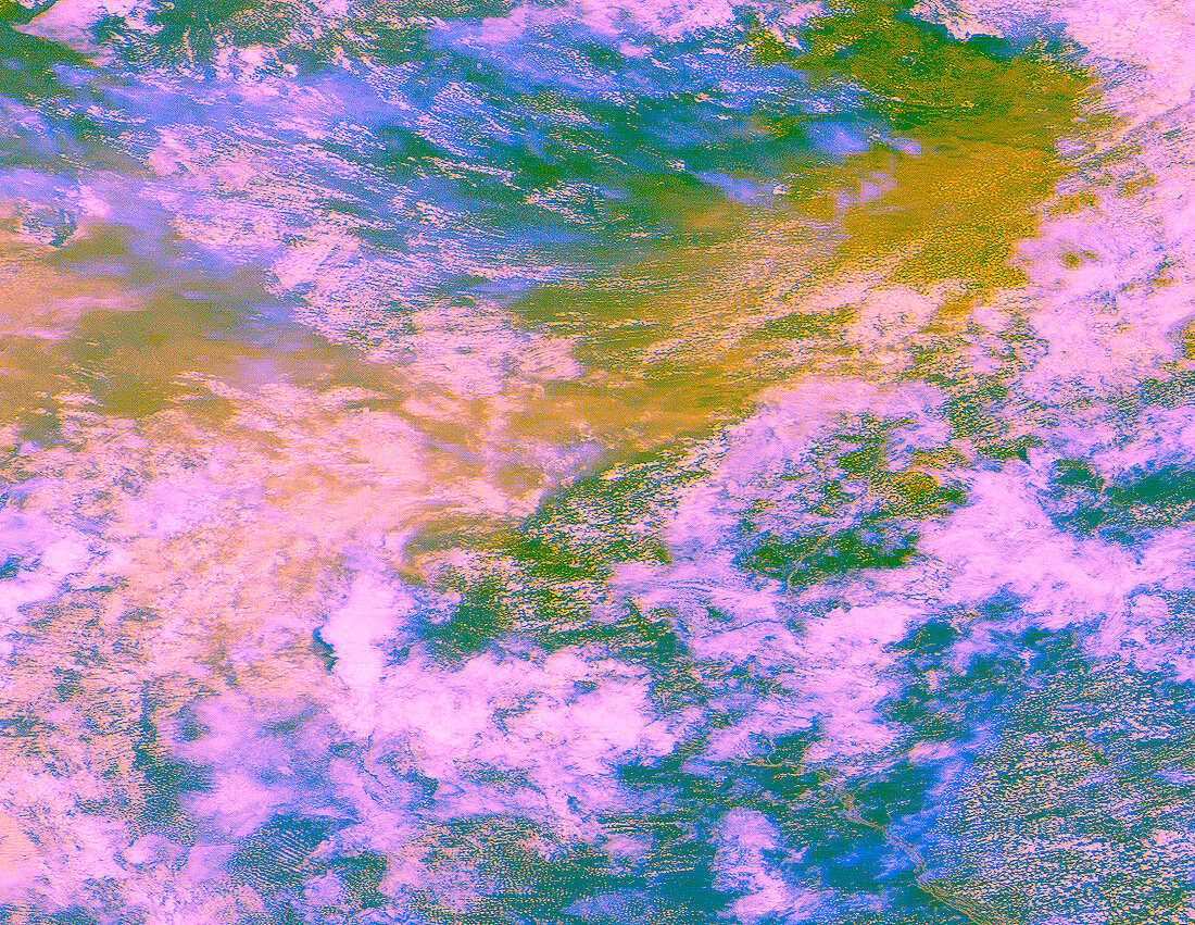
| Brazilian forest fires. Enhanced-colour satellite image of extensive rainforest fires in Roraima Province in northern Brazil on 29 March 1998. Smoke from the fires appears yellow/brown and is being carried westwards. North is at top. The smoke plumes are partially obscured by clouds (white/ blue). Rainforest is green; the Rio Negro river is seen at lower right. International alarm was raised at the extent of these fires approach- ing the borders of Venezuela (at top) and Guyana (upper right). Image taken by a GOES-8 satellite,covering an area of about 500x700 miles | |
| Lizenzart: | Lizenzpflichtig |
| Credit: | Science Photo Library / NOAA |
| Bildgröße: | 1188 px × 919 px |
| Modell-Rechte: | nicht erforderlich |
| Eigentums-Rechte: | nicht erforderlich |
| Restrictions: |
|
Preise für dieses Bild ab 15 €
Universitäten & Organisationen
(Informationsmaterial Digital, Informationsmaterial Print, Lehrmaterial Digital etc.)
ab 15 €
Redaktionell
(Bücher, Bücher: Sach- und Fachliteratur, Digitale Medien (redaktionell) etc.)
ab 30 €
Werbung
(Anzeigen, Aussenwerbung, Digitale Medien, Fernsehwerbung, Karten, Werbemittel, Zeitschriften etc.)
ab 55 €
Handelsprodukte
(bedruckte Textilie, Kalender, Postkarte, Grußkarte, Verpackung etc.)
ab 75 €
Pauschalpreise
Rechtepakete für die unbeschränkte Bildnutzung in Print oder Online
ab 495 €