Pre-flood rivers
Bildnummer 11738359
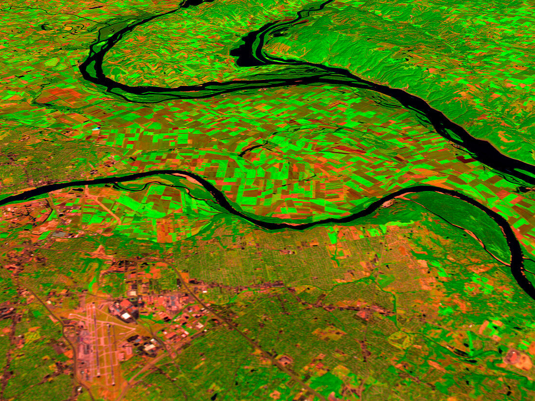
| Pre-flood rivers (image 1 of 2). Coloured three- dimensional computer image,based on satellite data,of three US rivers before they flooded. They are the Missouri (along centre),the Mississippi (upper left) and the Illinois (top centre). North is towards top. Bare soil,such as in the ploughed fields,is red,with water black and vegetation green. The record rainfall of summer 1993 caused the flooding. The image was produced from data collected on 14 August 1991 by the Thematic Mapper on the US Landsat 5 satellite,along with USGS terrain elevation data. For the rivers in flood see image E160/126 | |
| Lizenzart: | Lizenzpflichtig |
| Credit: | Science Photo Library / NASA's Goddard Space Flight Center |
| Bildgröße: | 2560 px × 1920 px |
| Modell-Rechte: | nicht erforderlich |
| Eigentums-Rechte: | nicht erforderlich |
| Restrictions: | - |
Preise für dieses Bild ab 15 €
Universitäten & Organisationen
(Informationsmaterial Digital, Informationsmaterial Print, Lehrmaterial Digital etc.)
ab 15 €
Redaktionell
(Bücher, Bücher: Sach- und Fachliteratur, Digitale Medien (redaktionell) etc.)
ab 30 €
Werbung
(Anzeigen, Aussenwerbung, Digitale Medien, Fernsehwerbung, Karten, Werbemittel, Zeitschriften etc.)
ab 55 €
Handelsprodukte
(bedruckte Textilie, Kalender, Postkarte, Grußkarte, Verpackung etc.)
ab 75 €
Pauschalpreise
Rechtepakete für die unbeschränkte Bildnutzung in Print oder Online
ab 495 €