Flooded Missouri River
Bildnummer 11738358
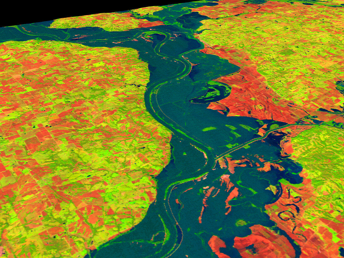
| Flooded Missouri River (image 2 of 2). Coloured three-dimensional computer image,based on satell- ite data,of the Missouri River,USA,in flood. North is at right. Flood water (blue) has covered most of the bare soil (red) of the ploughed fields beside the river. Vegetation is green. The record rainfall of summer 1993 caused the river to burst its banks and flood this large area of land. A flood of this size is expected to occur only once every 100 or more years. The image was produced from data collected on 27 September 1993 by the Thematic Mapper on the US Landsat 5 satellite. For the river before the flood see image E160/123 | |
| Lizenzart: | Lizenzpflichtig |
| Credit: | Science Photo Library / NASA's Goddard Space Flight Center |
| Bildgröße: | 2560 px × 1920 px |
| Modell-Rechte: | nicht erforderlich |
| Eigentums-Rechte: | nicht erforderlich |
| Restrictions: | - |
Preise für dieses Bild ab 15 €
Universitäten & Organisationen
(Informationsmaterial Digital, Informationsmaterial Print, Lehrmaterial Digital etc.)
ab 15 €
Redaktionell
(Bücher, Bücher: Sach- und Fachliteratur, Digitale Medien (redaktionell) etc.)
ab 30 €
Werbung
(Anzeigen, Aussenwerbung, Digitale Medien, Fernsehwerbung, Karten, Werbemittel, Zeitschriften etc.)
ab 55 €
Handelsprodukte
(bedruckte Textilie, Kalender, Postkarte, Grußkarte, Verpackung etc.)
ab 75 €
Pauschalpreise
Rechtepakete für die unbeschränkte Bildnutzung in Print oder Online
ab 495 €