Pre-flood Missouri River
Bildnummer 11738357
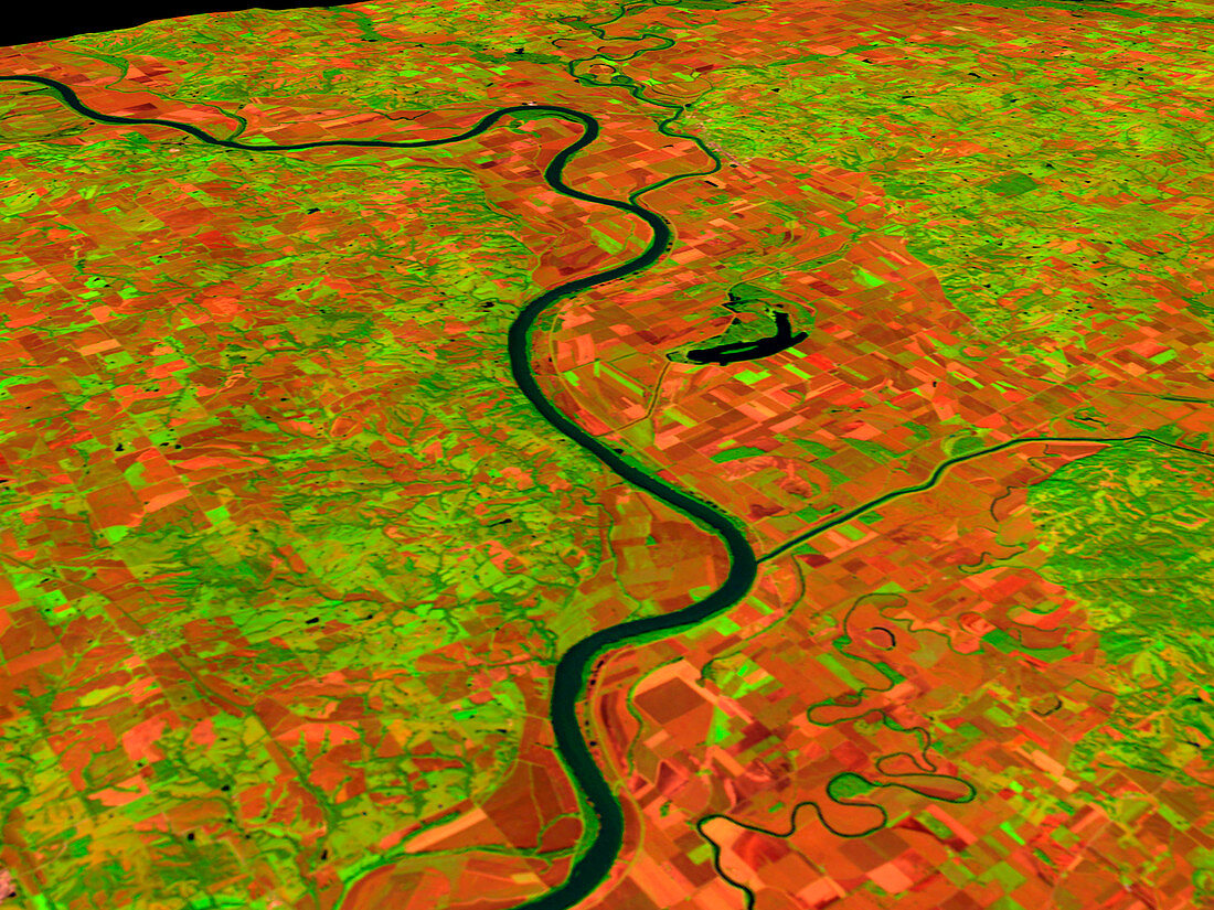
| Pre-flood Missouri River (image 1 of 2). Coloured three-dimensional computer image,based on satell- ite data,of the Missouri River,USA. The image was taken on 24 September 1992,before the river flooded in 1993. North is at right. Bare soil,such as in ploughed fields,is red,with vegetat- ion green and water black. The record rainfall of summer 1993 caused the river to burst its banks and flood a large area of land. A flood of this size should occur only once every 100 or more years. The image was produced from data collected by the Thematic Mapper on the US Landsat 5 satell- ite. For the river in flood see image E160/124 | |
| Lizenzart: | Lizenzpflichtig |
| Credit: | Science Photo Library / NASA's Goddard Space Flight Center |
| Bildgröße: | 2560 px × 1920 px |
| Modell-Rechte: | nicht erforderlich |
| Eigentums-Rechte: | nicht erforderlich |
| Restrictions: | - |
Preise für dieses Bild ab 15 €
Universitäten & Organisationen
(Informationsmaterial Digital, Informationsmaterial Print, Lehrmaterial Digital etc.)
ab 15 €
Redaktionell
(Bücher, Bücher: Sach- und Fachliteratur, Digitale Medien (redaktionell) etc.)
ab 30 €
Werbung
(Anzeigen, Aussenwerbung, Digitale Medien, Fernsehwerbung, Karten, Werbemittel, Zeitschriften etc.)
ab 55 €
Handelsprodukte
(bedruckte Textilie, Kalender, Postkarte, Grußkarte, Verpackung etc.)
ab 75 €
Pauschalpreise
Rechtepakete für die unbeschränkte Bildnutzung in Print oder Online
ab 495 €