Radar image showing flooding near Maastricht
Bildnummer 11738354
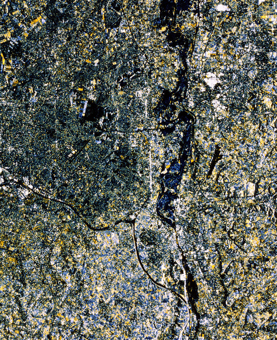
| Floods on the River Maas. Multitemporal radar image showing flooding of the River Maas near Maastricht,Netherlands,in 1995. This image was made by combining two frames,one taken in September 1994 and the other in January 1995. The flooded stretches are seen in blue,and cover an area of 3520 hectares. The River Maas runs from top to bottom of the frame,just right of centre. The dark line from centre left to lower right is a canal. Just above the junction of these is the city of Maastricht,seen as a cluster of bright white dots. The data for this image were gathered by the ERS-1 European radar mapping satellite | |
| Lizenzart: | Lizenzpflichtig |
| Credit: | Science Photo Library / ESA, EURIMAGE |
| Bildgröße: | 2888 px × 3543 px |
| Modell-Rechte: | nicht erforderlich |
| Eigentums-Rechte: | nicht erforderlich |
| Restrictions: |
|
Preise für dieses Bild ab 15 €
Universitäten & Organisationen
(Informationsmaterial Digital, Informationsmaterial Print, Lehrmaterial Digital etc.)
ab 15 €
Redaktionell
(Bücher, Bücher: Sach- und Fachliteratur, Digitale Medien (redaktionell) etc.)
ab 30 €
Werbung
(Anzeigen, Aussenwerbung, Digitale Medien, Fernsehwerbung, Karten, Werbemittel, Zeitschriften etc.)
ab 55 €
Handelsprodukte
(bedruckte Textilie, Kalender, Postkarte, Grußkarte, Verpackung etc.)
ab 75 €
Pauschalpreise
Rechtepakete für die unbeschränkte Bildnutzung in Print oder Online
ab 495 €