TM merge highlighting flooding,St,Louis area
Bildnummer 11738351
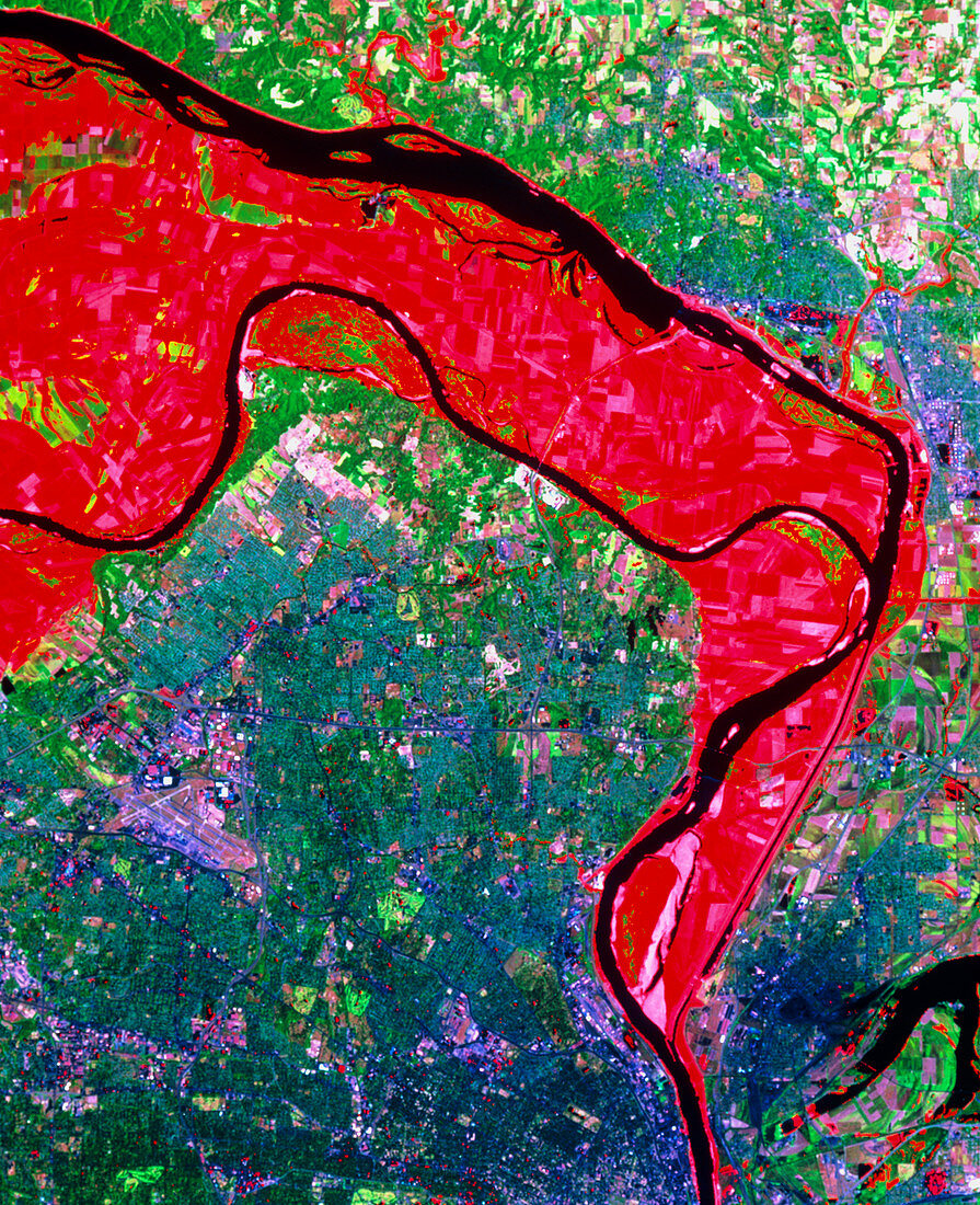
| St.Louis area during the 1993 floods. Enhanced colour satellite view of the area around St.Louis at the height of the flooding of the Mississippi and Missouri rivers in 1993. The city is the purple area near bottom centre. Red areas show the extent of the flooding of July 1993. This was highlighted by comparing an image made during the floods with an identical frame made three years earlier. The original (before the flood) river channels are shown in black; the Mississippi from top left to bottom right joined by the Missouri from centre left. The data were gathered by a Landsat satellite on 4 July 1988 and 18 July 1993 | |
| Lizenzart: | Lizenzpflichtig |
| Credit: | Science Photo Library / MDA Information Systems |
| Bildgröße: | 3273 px × 4022 px |
| Modell-Rechte: | nicht erforderlich |
| Eigentums-Rechte: | nicht erforderlich |
| Restrictions: | - |
Preise für dieses Bild ab 15 €
Universitäten & Organisationen
(Informationsmaterial Digital, Informationsmaterial Print, Lehrmaterial Digital etc.)
ab 15 €
Redaktionell
(Bücher, Bücher: Sach- und Fachliteratur, Digitale Medien (redaktionell) etc.)
ab 30 €
Werbung
(Anzeigen, Aussenwerbung, Digitale Medien, Fernsehwerbung, Karten, Werbemittel, Zeitschriften etc.)
ab 55 €
Handelsprodukte
(bedruckte Textilie, Kalender, Postkarte, Grußkarte, Verpackung etc.)
ab 75 €
Pauschalpreise
Rechtepakete für die unbeschränkte Bildnutzung in Print oder Online
ab 495 €