Flooding around St.Louis on 18 July 1993
Bildnummer 11738349
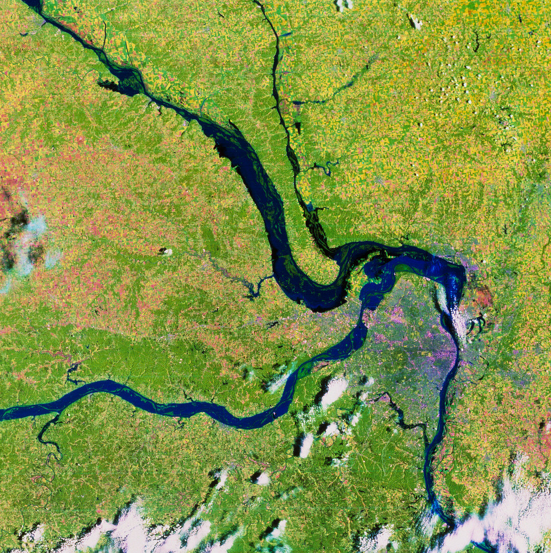
| St.Louis area during the 1993 floods. Satellite view of the area around St.Louis at the height of the flooding of the Mississippi and Missouri rivers in 1993. The city is the purple area to the right of centre. Blue and black areas show the extent of the flooding. The Mississippi River runs from top left to bottom right; the Missouri River flows from bottom left to join the Mississippi just north of the city. The River Illinois flows from upper centre. The data for this image were gathered by a Landsat satellite on 18 July 1993. Compare with E540/117,the same area seen on 4 July 1988 | |
| Lizenzart: | Lizenzpflichtig |
| Credit: | Science Photo Library / MDA Information Systems |
| Bildgröße: | 4329 px × 4344 px |
| Modell-Rechte: | nicht erforderlich |
| Eigentums-Rechte: | nicht erforderlich |
| Restrictions: | - |
Preise für dieses Bild ab 15 €
Universitäten & Organisationen
(Informationsmaterial Digital, Informationsmaterial Print, Lehrmaterial Digital etc.)
ab 15 €
Redaktionell
(Bücher, Bücher: Sach- und Fachliteratur, Digitale Medien (redaktionell) etc.)
ab 30 €
Werbung
(Anzeigen, Aussenwerbung, Digitale Medien, Fernsehwerbung, Karten, Werbemittel, Zeitschriften etc.)
ab 55 €
Handelsprodukte
(bedruckte Textilie, Kalender, Postkarte, Grußkarte, Verpackung etc.)
ab 75 €
Pauschalpreise
Rechtepakete für die unbeschränkte Bildnutzung in Print oder Online
ab 495 €