Hurricane Wilma
Bildnummer 11738064
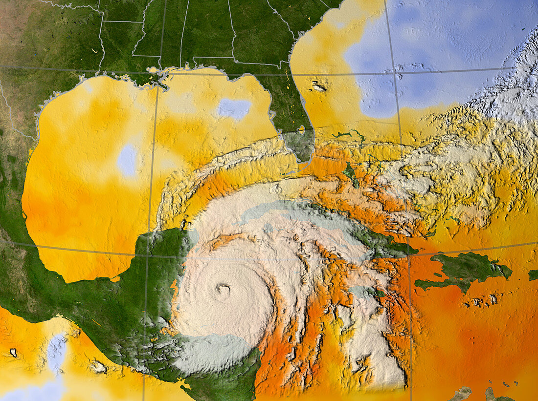
| Hurricane Wilma. Sea temperature data from NASA's Aqua satellite and a satellite image of hurricane Wilma as it approaches the Yucatan Peninsula,Mexico,on 20 October 2005. At this point the hurricane was a category 5 storm. Around the hurricane the sea temperature is 30 degrees Celsius (orange),several degrees warmer than the temperatures needed to form and fuel a hurricane. The coast of the US is at top and Cuba is at right. Wilma made landfall on the Yucatan Peninsula on 21 October as a category 4 hurricane,with sustained winds of over 240 kilometres per hour. It caused devastation along coastal tourist areas and cost at least 6 lives | |
| Lizenzart: | Lizenzpflichtig |
| Credit: | Science Photo Library / NASA |
| Bildgröße: | 2219 px × 1656 px |
| Modell-Rechte: | nicht erforderlich |
| Eigentums-Rechte: | nicht erforderlich |
| Restrictions: | - |
Preise für dieses Bild ab 15 €
Universitäten & Organisationen
(Informationsmaterial Digital, Informationsmaterial Print, Lehrmaterial Digital etc.)
ab 15 €
Redaktionell
(Bücher, Bücher: Sach- und Fachliteratur, Digitale Medien (redaktionell) etc.)
ab 30 €
Werbung
(Anzeigen, Aussenwerbung, Digitale Medien, Fernsehwerbung, Karten, Werbemittel, Zeitschriften etc.)
ab 55 €
Handelsprodukte
(bedruckte Textilie, Kalender, Postkarte, Grußkarte, Verpackung etc.)
ab 75 €
Pauschalpreise
Rechtepakete für die unbeschränkte Bildnutzung in Print oder Online
ab 495 €