Satellite image of Hurricane Floyd
Bildnummer 11737974
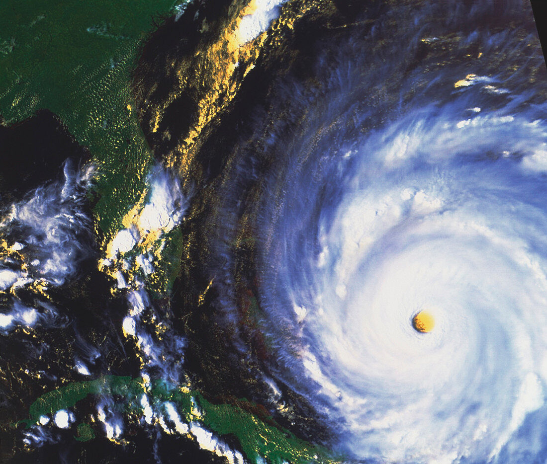
| Hurricane Floyd. Combined visible and infrared satellite image of Hurricane Floyd in the Atlantic Ocean off the coast of Florida,USA (upper left). North is at top. The hurricane is the swirl of white clouds around the central hole (the eye). Land,such as Cuba (bottom left),is green and water is black. The eye contains calmer cloud-free air at very low pressure. Around it winds reached over 140 miles per hour. After devastating the Bahamas,Hurricane Floyd hit Florida on September 16,going on to cause 40 deaths. Hurricanes are caused by large-scale evaporation and convection in warm tropical seas. Image taken on 13 September 1999 by the American NOAA-14 satellite | |
| Lizenzart: | Lizenzpflichtig |
| Credit: | Science Photo Library / NASA |
| Bildgröße: | 4067 px × 3455 px |
| Modell-Rechte: | nicht erforderlich |
| Eigentums-Rechte: | nicht erforderlich |
| Restrictions: | - |
Preise für dieses Bild ab 15 €
Universitäten & Organisationen
(Informationsmaterial Digital, Informationsmaterial Print, Lehrmaterial Digital etc.)
ab 15 €
Redaktionell
(Bücher, Bücher: Sach- und Fachliteratur, Digitale Medien (redaktionell) etc.)
ab 30 €
Werbung
(Anzeigen, Aussenwerbung, Digitale Medien, Fernsehwerbung, Karten, Werbemittel, Zeitschriften etc.)
ab 55 €
Handelsprodukte
(bedruckte Textilie, Kalender, Postkarte, Grußkarte, Verpackung etc.)
ab 75 €
Pauschalpreise
Rechtepakete für die unbeschränkte Bildnutzung in Print oder Online
ab 495 €
Keywords
- Auge,
- extrem,
- Florida,
- Hurrikan,
- Hurrikan Floyd,
- Klima,
- Kuba,
- Meteorologie,
- NOAA-14 Bilder,
- Sturm,
- Stürme,
- Weltall,
- Wetter,
- Wolke