Coloured satellite image of Hurricane Linda
Bildnummer 11737967
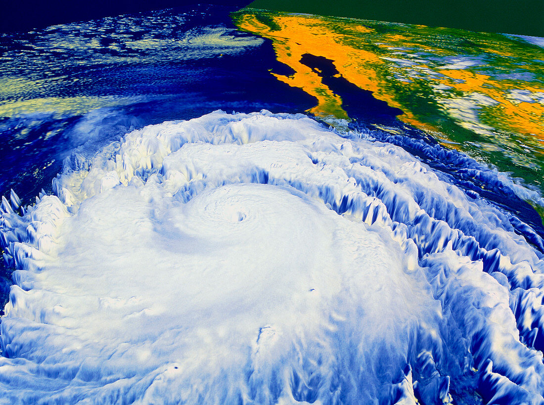
| Hurricane Linda. Coloured satellite image of Hurricane Linda off the coast of Mexico (at top right). North is towards the top left corner. The hurricane is the swirl of clouds surrounding the central hole (the "eye") at centre. The "eye" is an area of relatively calm,cloud-free air at very low pressure. Around it winds reached almost 190 miles per hour,making this the strongest hurricane on record in the Eastern Pacific (blue). Hurricanes form in tropical regions and are caused by large-scale evaporation and convection due to warm sea temperatures. Image taken on 12 September 1997 by the American GOES-9 satellite | |
| Lizenzart: | Lizenzpflichtig |
| Credit: | Science Photo Library / NASA's Goddard Space Flight Center |
| Bildgröße: | 4895 px × 3644 px |
| Modell-Rechte: | nicht erforderlich |
| Eigentums-Rechte: | nicht erforderlich |
| Restrictions: | - |
Preise für dieses Bild ab 15 €
Universitäten & Organisationen
(Informationsmaterial Digital, Informationsmaterial Print, Lehrmaterial Digital etc.)
ab 15 €
Redaktionell
(Bücher, Bücher: Sach- und Fachliteratur, Digitale Medien (redaktionell) etc.)
ab 30 €
Werbung
(Anzeigen, Aussenwerbung, Digitale Medien, Fernsehwerbung, Karten, Werbemittel, Zeitschriften etc.)
ab 55 €
Handelsprodukte
(bedruckte Textilie, Kalender, Postkarte, Grußkarte, Verpackung etc.)
ab 75 €
Pauschalpreise
Rechtepakete für die unbeschränkte Bildnutzung in Print oder Online
ab 495 €