Great Indian Desert sandstorm,June 2005
Bildnummer 11737824
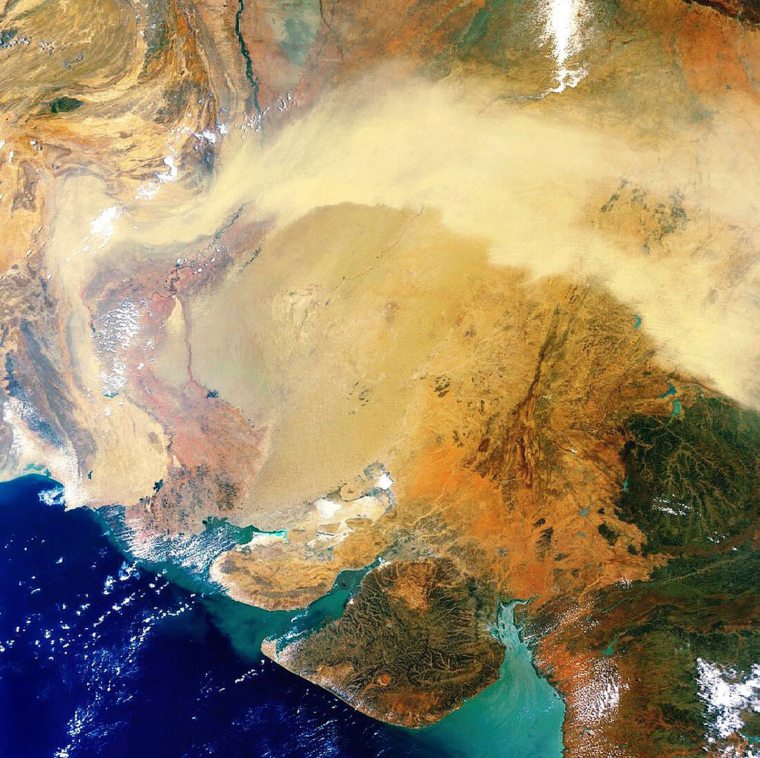
| Great Indian Desert sandstorm,satellite image. The sandstorm is the area of light brown across upper centre. The Great Indian Desert (also called the Thar Desert) occupies most of the image,straddling the border between Rajasthan State (upper right),Gujurat State (lower right),both in India,and Pakistan (centre left and the mountainous area at upper left). Gujurat's coastal region (green,lower right) is a fertile plain crossed by several rivers. River sediments are seen in the coastal gulfs,with darker blue (lower left) showing the oceanic depths of the Indian Ocean. This image covers an area 1943 kilometres across,and was obtained by the MERIS instrument on the Envisat satellite on 10 June 2005 | |
| Lizenzart: | Lizenzpflichtig |
| Credit: | Science Photo Library / ESA |
| Bildgröße: | 2300 px × 2293 px |
| Modell-Rechte: | nicht erforderlich |
| Eigentums-Rechte: | nicht erforderlich |
| Restrictions: |
|
Preise für dieses Bild ab 15 €
Universitäten & Organisationen
(Informationsmaterial Digital, Informationsmaterial Print, Lehrmaterial Digital etc.)
ab 15 €
Redaktionell
(Bücher, Bücher: Sach- und Fachliteratur, Digitale Medien (redaktionell) etc.)
ab 30 €
Werbung
(Anzeigen, Aussenwerbung, Digitale Medien, Fernsehwerbung, Karten, Werbemittel, Zeitschriften etc.)
ab 55 €
Handelsprodukte
(bedruckte Textilie, Kalender, Postkarte, Grußkarte, Verpackung etc.)
ab 75 €
Pauschalpreise
Rechtepakete für die unbeschränkte Bildnutzung in Print oder Online
ab 495 €
Keywords
- 21. Jahrhundert,
- Asiatisch,
- Asien,
- Berge,
- Erdbeobachtung,
- geografisch,
- Geographie,
- Indien,
- Indischer Ozean,
- Jahreszeit,
- Jahreszeiten,
- Klima,
- Küste,
- Küsten-,
- Land,
- Meer,
- Meteorologie,
- meteorologisch,
- Natur,
- Pakistan,
- Rajasthan,
- Sand,
- Satellit,
- Satellitenbild,
- Schwemmlandebene,
- Sommer,
- Sturm,
- Trocken,
- Trockenzeit,
- Vegetation,
- Weltall,
- Wetter,
- Wind,
- Windig,
- Wüste