Map of Antarctic ozone hole on 6 October 1991
Bildnummer 11736329
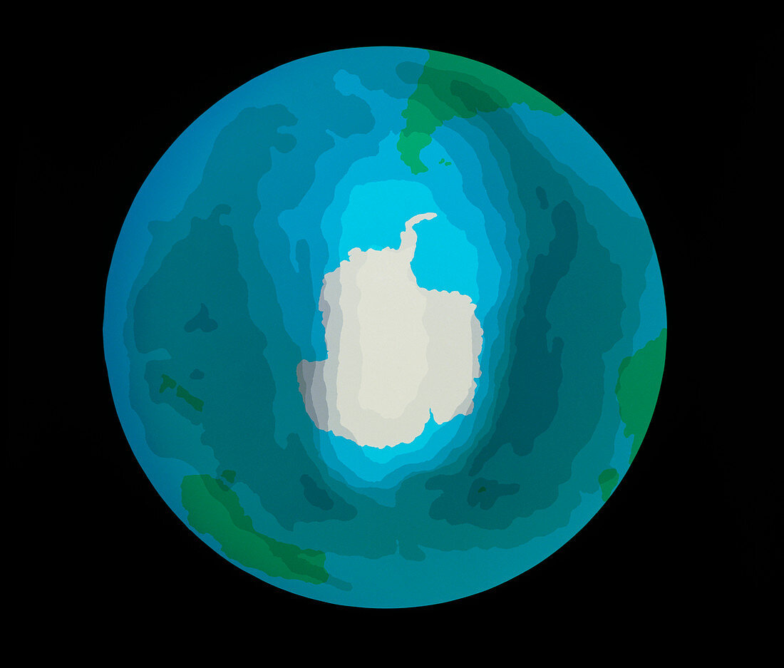
| False-colour map of the "ozone hole" over the Antarctic (white) on 6 October 1991. Based on data gathered by the Nimbus-7 satellite,the map shows the most severe depletion in the ozone layer over the Antarctic (white) up to that date. The ozone hole first appeared over the Antarctic in 1978. In the picture,the hole is seen as a transparent "window" surrounded by dark blue contour areas which represent increasing concentrations of ozone. The region of depleted ozone extends over the southern tip of South America at the top of the picture. Also visible (in green) are southern Africa,Australia & New Zealand | |
| Lizenzart: | Lizenzpflichtig |
| Credit: | Science Photo Library / Wells, John |
| Bildgröße: | 5362 px × 4568 px |
| Modell-Rechte: | nicht erforderlich |
| Eigentums-Rechte: | nicht erforderlich |
| Restrictions: | - |
Preise für dieses Bild ab 15 €
Universitäten & Organisationen
(Informationsmaterial Digital, Informationsmaterial Print, Lehrmaterial Digital etc.)
ab 15 €
Redaktionell
(Bücher, Bücher: Sach- und Fachliteratur, Digitale Medien (redaktionell) etc.)
ab 30 €
Werbung
(Anzeigen, Aussenwerbung, Digitale Medien, Fernsehwerbung, Karten, Werbemittel, Zeitschriften etc.)
ab 55 €
Handelsprodukte
(bedruckte Textilie, Kalender, Postkarte, Grußkarte, Verpackung etc.)
ab 75 €
Pauschalpreise
Rechtepakete für die unbeschränkte Bildnutzung in Print oder Online
ab 495 €