True-colour satellite image of Munster,Ireland
Bildnummer 11736224
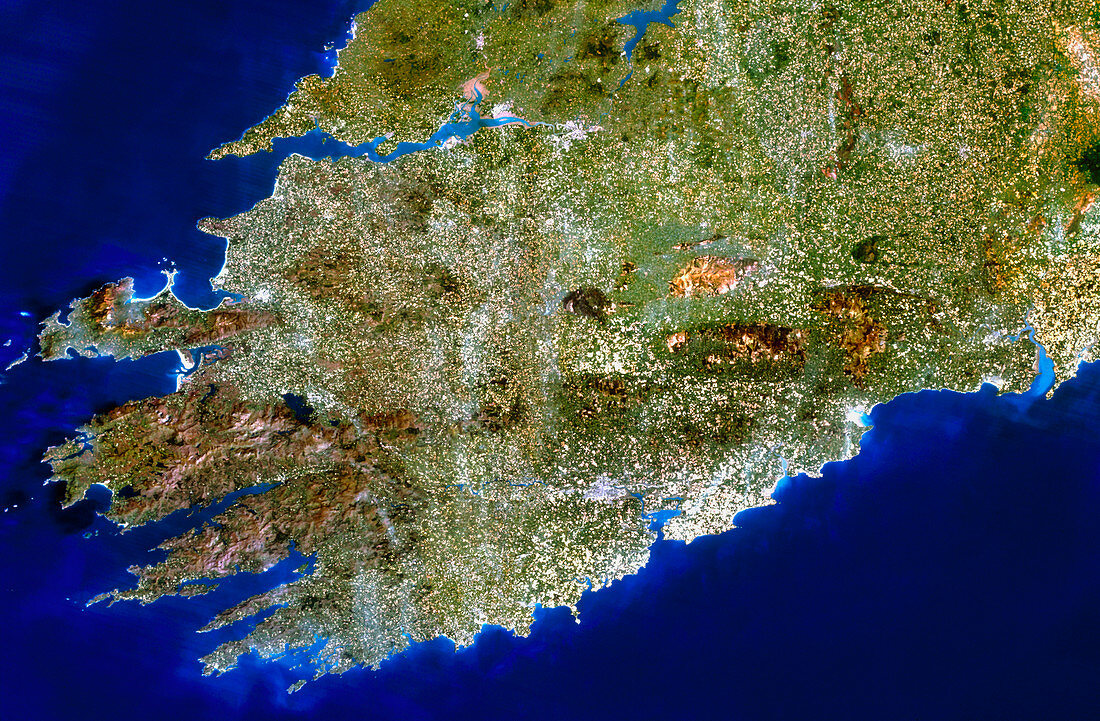
| Munster,Ireland. Satellite image of the province of Munster in the southwest of the Republic of Ireland. The colours approximate to natural tones. North is at top. The largest city in the region is Cork (at lower centre). Most of the surrounding area appears as a patchwork of agricultural fields. The extreme southwest coast is mountainous,with the MacGillycuddy's Reeks range just to the north of the Caha Mountains. The mouth of the River Shannon forms a long sea inlet at upper left. Image taken by the American Landsat-5 satellite | |
| Lizenzart: | Lizenzpflichtig |
| Credit: | Science Photo Library / Planetobserver |
| Bildgröße: | 3916 px × 2566 px |
| Modell-Rechte: | nicht erforderlich |
| Eigentums-Rechte: | nicht erforderlich |
| Restrictions: | - |
Preise für dieses Bild ab 15 €
Universitäten & Organisationen
(Informationsmaterial Digital, Informationsmaterial Print, Lehrmaterial Digital etc.)
ab 15 €
Redaktionell
(Bücher, Bücher: Sach- und Fachliteratur, Digitale Medien (redaktionell) etc.)
ab 30 €
Werbung
(Anzeigen, Aussenwerbung, Digitale Medien, Fernsehwerbung, Karten, Werbemittel, Zeitschriften etc.)
ab 55 €
Handelsprodukte
(bedruckte Textilie, Kalender, Postkarte, Grußkarte, Verpackung etc.)
ab 75 €
Pauschalpreise
Rechtepakete für die unbeschränkte Bildnutzung in Print oder Online
ab 495 €