True-colour satellite image of northern England
Bildnummer 11736222
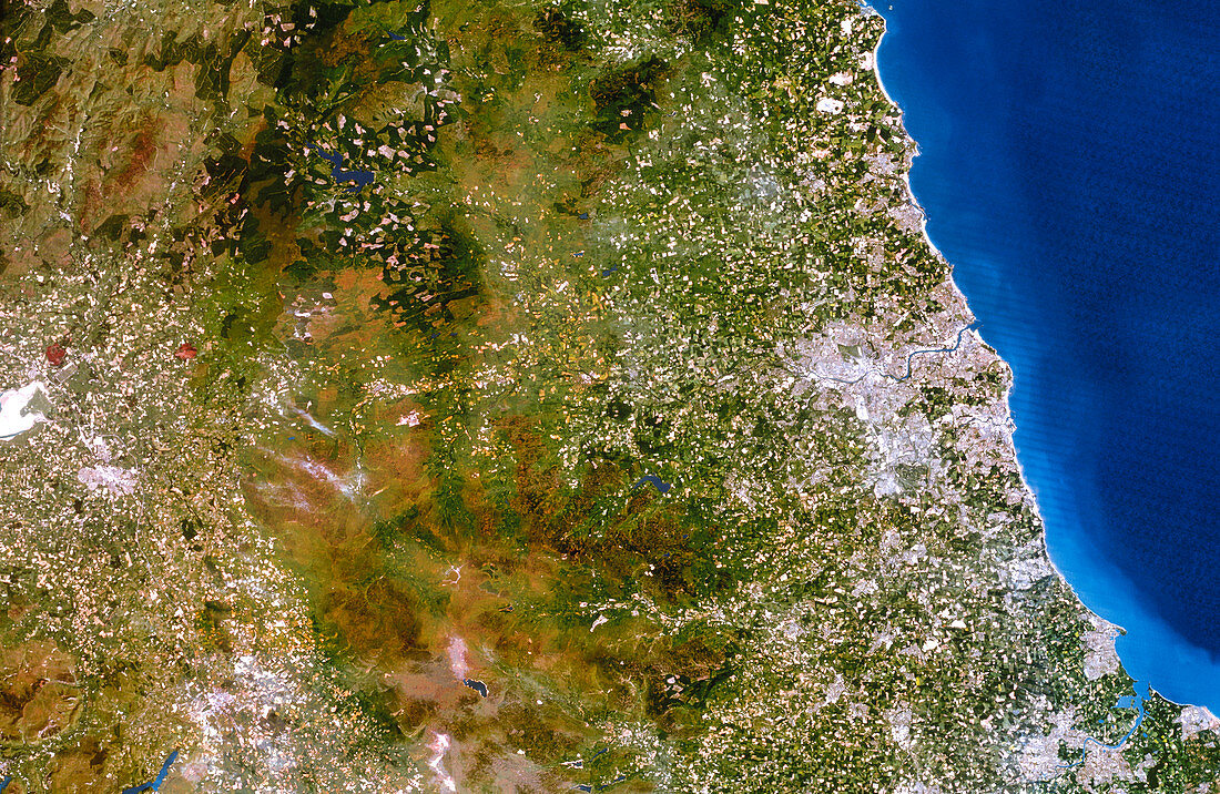
| Northern England. True-colour satellite image of northern England,showing the counties of Cumbria (at left),Northumberland (at upper right) and Durham (at lower right). North is at top. Cities seen here include Carlisle (at left),Newcastle upon Tyne (at centre right),and Middlesbrough (at bottom right). The urban areas are surrounded by a patchwork of agricultural fields. The western and eastern sides of the country are separated by the Pennine mountains (brown). Image taken by the American Landsat-5 satellite | |
| Lizenzart: | Lizenzpflichtig |
| Credit: | Science Photo Library / Planetobserver |
| Bildgröße: | 4961 px × 3230 px |
| Modell-Rechte: | nicht erforderlich |
| Eigentums-Rechte: | nicht erforderlich |
| Restrictions: | - |
Preise für dieses Bild ab 15 €
Universitäten & Organisationen
(Informationsmaterial Digital, Informationsmaterial Print, Lehrmaterial Digital etc.)
ab 15 €
Redaktionell
(Bücher, Bücher: Sach- und Fachliteratur, Digitale Medien (redaktionell) etc.)
ab 30 €
Werbung
(Anzeigen, Aussenwerbung, Digitale Medien, Fernsehwerbung, Karten, Werbemittel, Zeitschriften etc.)
ab 55 €
Handelsprodukte
(bedruckte Textilie, Kalender, Postkarte, Grußkarte, Verpackung etc.)
ab 75 €
Pauschalpreise
Rechtepakete für die unbeschränkte Bildnutzung in Print oder Online
ab 495 €