True-colour satellite image of western Scotland
Bildnummer 11736221
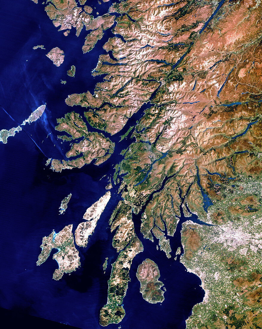
| Western Scotland. Satellite image of western Scotland. The colours approximate to natural tones. North is at top. The city of Glasgow lies in the lowlands at lower right. The sparsely-populated Highland region (brown) lies to the north of Glasgow. The area at upper centre includes the highest point in the British Isles,Ben Nevis (1343 metres). The rugged coastline includes the Firth of Clyde (at bottom right),Firth of Lorn (at centre left),and Loch Linnhe (at upper centre). The islands of Mull (at centre left),Jura (at lower left) and Islay (at bottom left) form part of the Hebrides archipelago. Image taken by a Landsat-5 satellite | |
| Lizenzart: | Lizenzpflichtig |
| Credit: | Science Photo Library / Planetobserver |
| Bildgröße: | 3405 px × 4271 px |
| Modell-Rechte: | nicht erforderlich |
| Eigentums-Rechte: | nicht erforderlich |
| Restrictions: | - |
Preise für dieses Bild ab 15 €
Universitäten & Organisationen
(Informationsmaterial Digital, Informationsmaterial Print, Lehrmaterial Digital etc.)
ab 15 €
Redaktionell
(Bücher, Bücher: Sach- und Fachliteratur, Digitale Medien (redaktionell) etc.)
ab 30 €
Werbung
(Anzeigen, Aussenwerbung, Digitale Medien, Fernsehwerbung, Karten, Werbemittel, Zeitschriften etc.)
ab 55 €
Handelsprodukte
(bedruckte Textilie, Kalender, Postkarte, Grußkarte, Verpackung etc.)
ab 75 €
Pauschalpreise
Rechtepakete für die unbeschränkte Bildnutzung in Print oder Online
ab 495 €