True-colour satellite image of southwest Scotland
Bildnummer 11736211
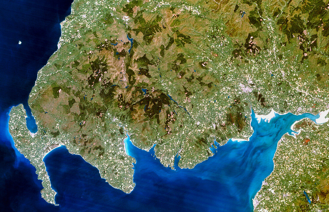
| Southwest Scotland. True-colour satellite image of the region of Dumfries and Galloway in southwest Scotland,Great Britain. North is at top. The city of Dumfries is at centre right,but the rest of the region is largely rural. Up to 60% of Dumfries and Galloway is covered by moorland and mountains,and the region has numerous lakes (lochs). The rugged coastline includes the Solway Firth (at lower right),Wigtown Bay (at lower centre),and Luce Bay (at lower left). Image taken by a Landsat-5 satellite | |
| Lizenzart: | Lizenzpflichtig |
| Credit: | Science Photo Library / Planetobserver |
| Bildgröße: | 5041 px × 3243 px |
| Modell-Rechte: | nicht erforderlich |
| Eigentums-Rechte: | nicht erforderlich |
| Restrictions: | - |
Preise für dieses Bild ab 15 €
Universitäten & Organisationen
(Informationsmaterial Digital, Informationsmaterial Print, Lehrmaterial Digital etc.)
ab 15 €
Redaktionell
(Bücher, Bücher: Sach- und Fachliteratur, Digitale Medien (redaktionell) etc.)
ab 30 €
Werbung
(Anzeigen, Aussenwerbung, Digitale Medien, Fernsehwerbung, Karten, Werbemittel, Zeitschriften etc.)
ab 55 €
Handelsprodukte
(bedruckte Textilie, Kalender, Postkarte, Grußkarte, Verpackung etc.)
ab 75 €
Pauschalpreise
Rechtepakete für die unbeschränkte Bildnutzung in Print oder Online
ab 495 €