True colour satellite image of northwest Wales
Bildnummer 11736210
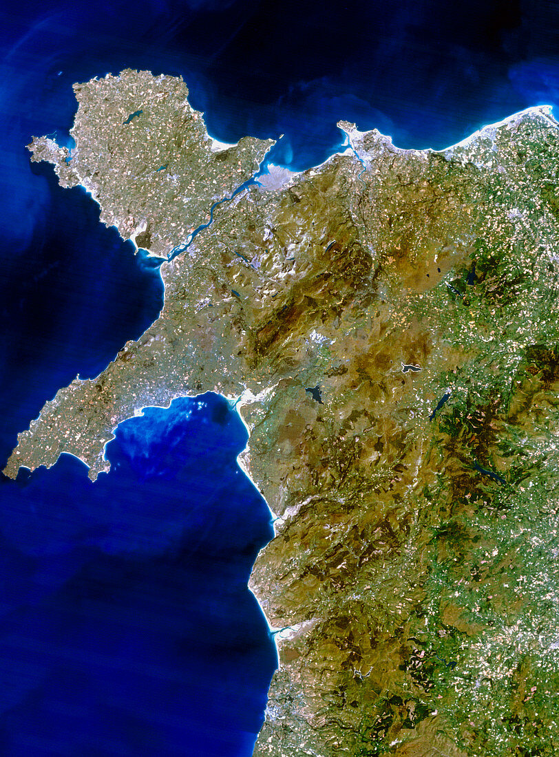
| Wales. True-colour satellite image of northwest Wales,Great Britain. North is at top. The city of Bangor is on the coast at upper centre,but the rest of the region is largely rural. The large island off the northwest coast is Anglesey; it is separated from the mainland by the Menai Strait. At upper centre is the Snowdonia region,which contains the highest point in Wales,Mount Snowdon (1085 metres). The Cambrian mountains stretch from north to south in the lower frame. At lower left is Cardigan Bay,the largest in Wales. Image taken from data collected by the Landsat-5 satellite | |
| Lizenzart: | Lizenzpflichtig |
| Credit: | Science Photo Library / Planetobserver |
| Bildgröße: | 5229 px × 7087 px |
| Modell-Rechte: | nicht erforderlich |
| Eigentums-Rechte: | nicht erforderlich |
| Restrictions: | - |
Preise für dieses Bild ab 15 €
Universitäten & Organisationen
(Informationsmaterial Digital, Informationsmaterial Print, Lehrmaterial Digital etc.)
ab 15 €
Redaktionell
(Bücher, Bücher: Sach- und Fachliteratur, Digitale Medien (redaktionell) etc.)
ab 30 €
Werbung
(Anzeigen, Aussenwerbung, Digitale Medien, Fernsehwerbung, Karten, Werbemittel, Zeitschriften etc.)
ab 55 €
Handelsprodukte
(bedruckte Textilie, Kalender, Postkarte, Grußkarte, Verpackung etc.)
ab 75 €
Pauschalpreise
Rechtepakete für die unbeschränkte Bildnutzung in Print oder Online
ab 495 €