True-colour satellite image of East Anglia,UK
Bildnummer 11736201
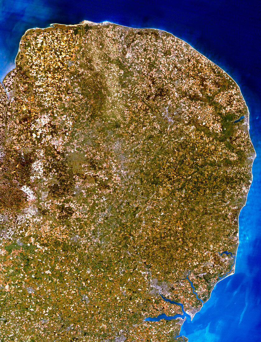
| East Anglia. Satellite image of East Anglia,England. The colours approximate to natural tones. North is at top. East Anglia is a predominantly low-relief agricultural area,as seen by the many green tones. Urban areas (grey) include Norwich (at upper right) and Ipswich (at lower right). The dark green area on the northeast coast is the Norfolk Broads,a famous inland waterway network. Note also the heavy sedimentation off shore (pale blue). The data for this image was gathered by the Landsat-5 satellite | |
| Lizenzart: | Lizenzpflichtig |
| Credit: | Science Photo Library / Planetobserver |
| Bildgröße: | 3693 px × 4843 px |
| Modell-Rechte: | nicht erforderlich |
| Eigentums-Rechte: | nicht erforderlich |
| Restrictions: | - |
Preise für dieses Bild ab 15 €
Universitäten & Organisationen
(Informationsmaterial Digital, Informationsmaterial Print, Lehrmaterial Digital etc.)
ab 15 €
Redaktionell
(Bücher, Bücher: Sach- und Fachliteratur, Digitale Medien (redaktionell) etc.)
ab 30 €
Werbung
(Anzeigen, Aussenwerbung, Digitale Medien, Fernsehwerbung, Karten, Werbemittel, Zeitschriften etc.)
ab 55 €
Handelsprodukte
(bedruckte Textilie, Kalender, Postkarte, Grußkarte, Verpackung etc.)
ab 75 €
Pauschalpreise
Rechtepakete für die unbeschränkte Bildnutzung in Print oder Online
ab 495 €