True-colour satellite image of north-east England
Bildnummer 11736200
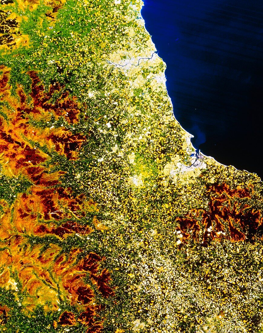
| North-east England. True-colour satellite image of north-east England. North is at top. The city of Newcastle-upon-Tyne lies on the river Tyne at upper centre. The smaller city to the south of it is Sunderland. At centre right,on the coast of the North Sea,is the town of Hartlepool. Middlesbrough is just inland of Hartlepool,whilst further inland (at centre) is the town of Darlington. At bottom right is the city of York; the agricultural area running up through the centre of the image is known as the Vale of York. The brown of the Pennine hills (at left) and Yorkshire Moors (at lower right) also appear | |
| Lizenzart: | Lizenzpflichtig |
| Credit: | Science Photo Library / NRSC LTD |
| Bildgröße: | 3731 px × 4724 px |
| Modell-Rechte: | nicht erforderlich |
| Eigentums-Rechte: | nicht erforderlich |
| Restrictions: | - |
Preise für dieses Bild ab 15 €
Universitäten & Organisationen
(Informationsmaterial Digital, Informationsmaterial Print, Lehrmaterial Digital etc.)
ab 15 €
Redaktionell
(Bücher, Bücher: Sach- und Fachliteratur, Digitale Medien (redaktionell) etc.)
ab 30 €
Werbung
(Anzeigen, Aussenwerbung, Digitale Medien, Fernsehwerbung, Karten, Werbemittel, Zeitschriften etc.)
ab 55 €
Handelsprodukte
(bedruckte Textilie, Kalender, Postkarte, Grußkarte, Verpackung etc.)
ab 75 €
Pauschalpreise
Rechtepakete für die unbeschränkte Bildnutzung in Print oder Online
ab 495 €