Infrared satellite image of Scotland,UK
Bildnummer 11736198
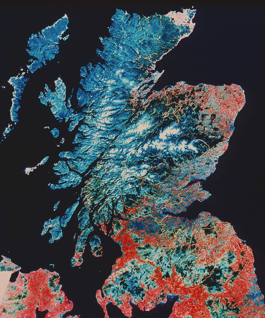
| Scotland. Infrared satellite image of Scotland,a part of Great Britain,with the county borders overlaid as yellow lines. North is at top. In the infrared range dense vegetation appears red,grassland is light blue,urban areas are dark blue,snow is white and water is black. The Grampian Mountains (at centre),Highlands (upper left) and Southern Uplands (lower centre) are visible. The capital of Scotland,Edinburgh,lies on the east coast of the lowlands between the Grampians and the Southern Uplands. To the city's west is Scotland's other main city,Glasgow. At top left are the Hebrides Isles. Image taken by a Landsat satellite | |
| Lizenzart: | Lizenzpflichtig |
| Credit: | Science Photo Library / NRSC LTD |
| Bildgröße: | 3455 px × 4147 px |
| Modell-Rechte: | nicht erforderlich |
| Eigentums-Rechte: | nicht erforderlich |
| Restrictions: | - |
Preise für dieses Bild ab 15 €
Universitäten & Organisationen
(Informationsmaterial Digital, Informationsmaterial Print, Lehrmaterial Digital etc.)
ab 15 €
Redaktionell
(Bücher, Bücher: Sach- und Fachliteratur, Digitale Medien (redaktionell) etc.)
ab 30 €
Werbung
(Anzeigen, Aussenwerbung, Digitale Medien, Fernsehwerbung, Karten, Werbemittel, Zeitschriften etc.)
ab 55 €
Handelsprodukte
(bedruckte Textilie, Kalender, Postkarte, Grußkarte, Verpackung etc.)
ab 75 €
Pauschalpreise
Rechtepakete für die unbeschränkte Bildnutzung in Print oder Online
ab 495 €