Satellite image of the northern Irish sea
Bildnummer 11736194
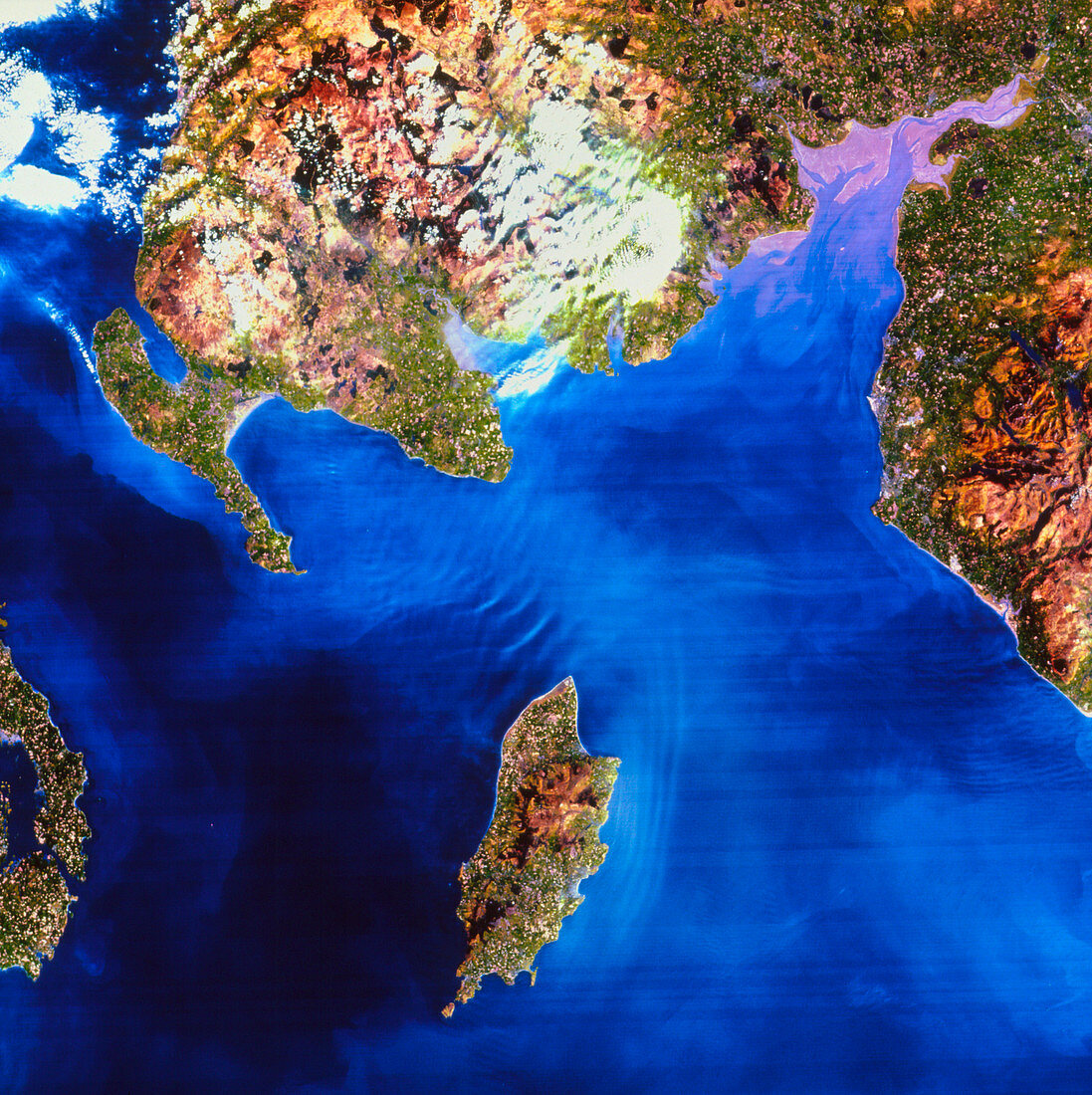
| Satellite image of the Northern Irish Sea. In this image,the colours approximate to natural tones. Just below centre is the Isle of Man. At the top of the frame is Galloway,part of Scotland,and at right is Cumbria (the Lake District) in England. Between these is the Solway Firth,a large river estuary with extensive sedimentation. At bottom left is part of County Down in Northern Ireland. The water of the Irish sea shows many sediment bars (pale) which are built up by long-wavelength standing tidal waves. The large white areas at top centre and upper left are banks of cloud | |
| Lizenzart: | Lizenzpflichtig |
| Credit: | Science Photo Library / NRSC LTD |
| Bildgröße: | 3533 px × 3543 px |
| Modell-Rechte: | nicht erforderlich |
| Eigentums-Rechte: | nicht erforderlich |
| Restrictions: | - |
Preise für dieses Bild ab 15 €
Universitäten & Organisationen
(Informationsmaterial Digital, Informationsmaterial Print, Lehrmaterial Digital etc.)
ab 15 €
Redaktionell
(Bücher, Bücher: Sach- und Fachliteratur, Digitale Medien (redaktionell) etc.)
ab 30 €
Werbung
(Anzeigen, Aussenwerbung, Digitale Medien, Fernsehwerbung, Karten, Werbemittel, Zeitschriften etc.)
ab 55 €
Handelsprodukte
(bedruckte Textilie, Kalender, Postkarte, Grußkarte, Verpackung etc.)
ab 75 €
Pauschalpreise
Rechtepakete für die unbeschränkte Bildnutzung in Print oder Online
ab 495 €